File:Gauges of the Na Borges catchment.png
Jump to navigation
Jump to search
No higher resolution available.
Gauges_of_the_Na_Borges_catchment.png (500 × 382 pixels, file size: 218 KB, MIME type: image/png)
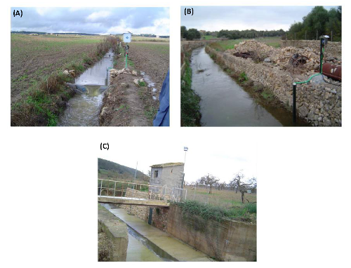
(A) An upstream view of the Can Revull (1 km2) monitoring station; (B) Downstream view of the Son Pou (142 km2) monitoring station; (C) Downstream view of the Sa Vall (264 km2) gauging station. Figure adapted from Estrany (2009)
File history
Click on a date/time to view the file as it appeared at that time.
| Date/Time | Thumbnail | Dimensions | User | Comment | |
|---|---|---|---|---|---|
| current | 10:02, 18 February 2016 | | 500 × 382 (218 KB) | Thomas (talk | contribs) | (A) An upstream view of the Can Revull (1 km2) monitoring station; (B) Downstream view of the Son Pou (142 km2) monitoring station; (C) Downstream view of the Sa Vall (264 km2) gauging station. Figure adapted from Estrany (2009) |
You cannot overwrite this file.
File usage
The following page uses this file: