File:Na Borges catchment.png
Jump to navigation
Jump to search
No higher resolution available.
Na_Borges_catchment.png (550 × 443 pixels, file size: 222 KB, MIME type: image/png)
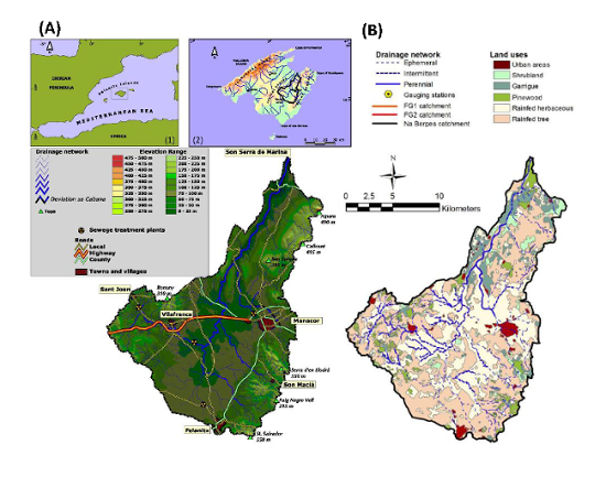
(A) Map of the Na Borges catchment; upset maps show: (1) Mallorca location in the Western Mediterranean, (2) Na Borges catchment location in Mallorca. (B) Main land uses at the Na Borges catchment. Figure adapted from Estrany (2009) and López-Tarazón and Estrany (2016).
File history
Click on a date/time to view the file as it appeared at that time.
| Date/Time | Thumbnail | Dimensions | User | Comment | |
|---|---|---|---|---|---|
| current | 09:59, 18 February 2016 | | 550 × 443 (222 KB) | Thomas (talk | contribs) | (A) Map of the Na Borges catchment; upset maps show: (1) Mallorca location in the Western Mediterranean, (2) Na Borges catchment location in Mallorca. (B) Main land uses at the Na Borges catchment. Figure adapted from Estrany (2009) and López-Tarazón an |
You cannot overwrite this file.
File usage
The following page uses this file: