File:Sa Font de la Vila catchment.jpg
Jump to navigation
Jump to search
No higher resolution available.
Sa_Font_de_la_Vila_catchment.jpg (400 × 566 pixels, file size: 269 KB, MIME type: image/jpeg)
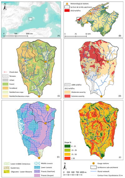
A) Location of Palma within the Mediterranean; B) Location of the Sa Font de la Vila catchment within the island of Mallorca; C) Main Landuses; D) Affectation of the 1994 and 2013 wildfires; E) Main geological units; F) Map of slopes.
File history
Click on a date/time to view the file as it appeared at that time.
| Date/Time | Thumbnail | Dimensions | User | Comment | |
|---|---|---|---|---|---|
| current | 14:01, 19 February 2016 | | 400 × 566 (269 KB) | Thomas (talk | contribs) | A) Location of Palma within the Mediterranean; B) Location of the Sa Font de la Vila catchment within the island of Mallorca; C) Main Landuses; D) Affectation of the 1994 and 2013 wildfires; E) Main geological units; F) Map of slopes. |
You cannot overwrite this file.
File usage
The following page uses this file: