HydroGeoEcological Observatory Ésera-Isábena (Spain)
Location
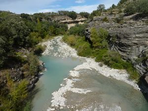
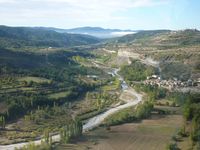
The Ésera-Isábena catchments are located in Aragon, Spain, within the Ebro watershed. The semi-arid region where they are located is a protected ecological area of the European Natura 2000 network. It exhibits prominent climatic, geological, geomorphological and hydrological conditions. Belonging to these features, one may consider strongly variable river beds, wide-spread badlands with exposed sediment layers, heavy storms in late summer adjacent to a distinct dry season and discontinuities in agricultural usage. The eroded sediments of the river basins are transported by water fluxes into the Barasona reservoir, which influences the capacity of the reservoir as an agriculturally important water storage.
Catchment size
The Ésera Catchment covers an area of 906 km², the neighbouring Isábena Catchment an area of 435 km².
Climate
The climate of the Ésera and the Isábena Catchments is a typical Mediterranean mountainous type with a mean annual precipitation rates of 600 to 2000 mm and an average potential evaporation rate of 550 to 750 mm. Both rates show a strong south-north gradient, which can be related to the strong topographical difference of altitude within the watersheds ranging from 580 m to 3400 m amsl. The major rivers in the catchment never dry up, although flows are low during the summer and some of the tributaries of the Isábena and Ésera Rivers exhibit ephemeral behaviour with no flow at the end of the dry season. Most floods occur due to the passing of cold fronts in spring and to local thunderstorms in autumn and winter.
Context of investigation
The investigation focuses mainly on the (inter-) relation of transfer, storage and re-entrainment processes that determine the distribution of water and sediments among different landscape components, shortly named the connectivity of water and sediments. Comprehensive measurements from plot to meso-scale will be achieved by field works and remote sensing campaigns, including multispectral flight campaigns, repetitive laser volume-scans, as well as several hydrological observations. The collected data shall provide an input for a further developed modelling of fluxes and connectivity phenomena of water and sediments with the WASA-SED model.
Measurements/Equipment
A description of the deployed measurement devices and experiments can be found in the SESAM project webpage [1]. Presentations about the monitoring network are given in the following presentations:
- Generation, transport and transient storage of sediments in meso-scale dryland catchments [2]
- Water and Sediment Fluxes in the Villacarli Catchment [3]
Links to project webpages
Further information under the tentative webpage of the Hydro-Geomorphological-Ecological Observatory [4] SESAM [5] SCARCE [6] BadlandScan [7] EUFAR [8]
References
- Brosinsky, A., Francke, T., Segl, K., López-Tarazón,J.-A., Sommerer, E., Foerster S., 2014: Spectral fingerprinting: Sediment source variability: Comparison and combination of sediment flux measurements and spectral fingerprinting, Journal of Soil and Sediment Science 14, 1949-1964, DOI: 10.1007/s11368-014-0925-1.
- Francke, T. 2009. Measurement and modelling of water and sediment fluxes in meso-scale dryland catchments. Dissertation, University of Potsdam, Germany,. URN: urn:nbn:de:kobv:517-opus-31525, URL: http://opus.kobv.de/ubp/volltexte/2009/3152/
- Francke, T., Werb, S., Sommerer, E., López-TarazónJ:-A., 2014: Analysis of runoff, sediment dynamics and sediment yield of subcatchments in the highly erodible Isábena catchment, Central Pyrenees, Journal of Soil and Sediment Science 14, 1909–1920, DOI: 10.1007/s11368-014-0990-5.


