Hütelmoor catchment
Location
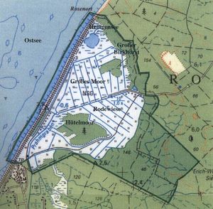
In the Rostocker Heide, Mecklenburg-Western Pomerania, Germany, 54°12′ N, 12°10′ E
Catchment size
10 km²
Climate
Maritime, anual precipitation 610 mm, anual ETp 640 mm, mean yearly temperature 8.3°C
Geology
Glacifuvial, with intensive peat evolution
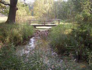
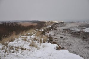
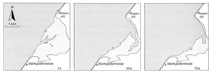
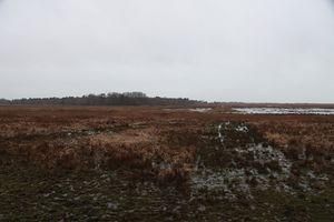
The fen is separated from the Baltic Sea by a dune dike installed in 1963 which increased fresh water supply. The area had been intensively drained for meadow usage since the 1970s with dropping water levels down to 1.60 m below ground surface. Peat decomposed rapidly and was identified as sapric histosol in 2010. Peat depths range between 1 and 3 m with alternating layers of sandy sediments as a result of flooding events. In the 1990s, decreasing yields due to proceeding peat degradation promoted the shift to a more ecological focus on peatland use across mid-Europe. For nature protection purposes first restoration measures were taken in 1992 by closing the main ditch (Schoenfeld-Bockholdt et al. 2005). Almost 20 years later, in 2009 a river bed sill was installed to permanently increase the water level to or above ground surface. Since then, the fen is permanently inundated with water levels up to 1.00 m above ground surface. During the last severe storm serge 1995 the dune dike breached and the complete wetland site was flooded. In the course of coastal protection the dune was rebuild. Due to redevelopment strategies the closed by village Markgrafenheide was secured by a ring dike and the coast line with the dike dune of the nature conservation area was abandoned which lead to a decay of dune and breakwaters.
Topography
0-40 m above sea level
Vegetation/Land use
Forest 60 %, pasture 30%, fen 10% dominant vegetation in the fen by a patchy pattern of dense Common reed stands (Phragmites australis) at drier parts sedge (Carex acutiformis) mixed stands of Sea and Grey Clubrush (Bolboschoenus maritimus (L.) Palla, Schoenoplectus tabernaemontani (C.C. Gmel.) Palla) present relics of former brackish conditions
Context of investigation
CH4 emission, salinisation, hydrological processes, interactions to nature conservation strategies
Measurements/Equipment
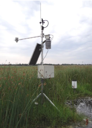
- Meteorological station
- Runoff
- Water level (diver) and runoff
- electrical conductivity (diver)
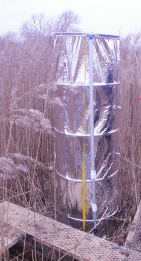
- soil moisture ( TDR, impedance FDR| Theta porobes , capacitance FDR| 5TE Decagon, TMS - sensor, profile probe )
- CH4 emission, chamber measurment
- Eddi covariance
- water level
- Water level + electric conductivity
Links to project webpages
other Links
- Rostocker Heide at Wikipedia
- Chair for Hydrology and Chair for Landscape Ecology and Site Evaluation University Rostock
- Small hydrological research basins
References
- Bohne, K., Bohne, B., Prediction of salinization by flooding sandy soils with brackish water, in Fock, T., Hergarden, K., Repasi, D., Salt grasslands and coastal meadows in the Baltic Sea region, PROCEEDINGS OF THE 1ST CONFERENCE, Neubrandenburg, Reihe A: Band 18, 2002.
- Bohne, B., Bohne, K., Monitoring zum Wasserhaushalt einer auf litoralem Versumpfungsmoor gewachsenen Regenmoorkalotte - Beispiel Naturschutzgebiet "Hütelmoor" bei Rostock. In: Stüdemann, O., Aspekte der Geoökologie Weißensee Verlag, Berlin, 2008.
- Hahn , J., Köhler, S., Glatzel, S., Jurasinski, G., Methane Exchange in a Coastal Fen in the First Year after Flooding - A Systems Shift, PLOS ONE, 10(10), e0140657, DOI: 10.1371/journal.pone.0140657.
- Hübner, E., Graeff, T., Küstenhydrologie und topographie im Hütemoor. Project work, University of Potsdam, Germany, 2013.
- Koch, S., Jurasinski, G., Koebsch, F., Koch, M., Glatzel, S., Spatial Variability of Annual Estimates of Methane Emissions in a Phragmites Australis (Cav.) Trin ex Steud. Dominated Restored Coastal Brackish Fen, Wetlands, DOI: 10.1007/s13157-014-0528-z, 2014.
- Koebsch, F., Jurasinski, G., Koch, M., Hofmann, J., Glatzel, S., Controls for multi-scale temporal variation in ecosystem methane exchange during the growing season of a permanently inundated fen, Agricultural and Forest Meteorology 204, 94-105, DOI: 10.1016/j.agrformet.2015.02.002, 2015.
- Koebsch, F., Glatzel, S., Jurasinski, G., Vegetation controls methane emissions in a coastal brackish fen, WETLANDS ECOLOGY AND MANAGEMENT 21(5), 323-337, DOI: 10.1007/s11273-013-9304-8, 2013.
- Koebsch, F., Glatzel, S., Hofmann, J., Forbrich, I., Jurasinski, G., CO2 exchange of a temperate fen during the conversion from moderately rewetting to flooding, JOURNAL OF GEOPHYSICAL RESEARCH-BIOGEOSCIENCES 118(2), 940-950, DOI: 10.1002/jgrg.20069, 2013.
- Koebsch, F., Jurasinski, G., Koch, S., Glatzel, S., Controls for multi-scale temporal variation in ecosystem methane exchange during the growing season of a permanently inundated fen, Agricultural and Forest Meteorology 204, 94–105, DOI: http://dx.doi.org/10.1016/j.agrformet.2015.02.002, 2015.
- Kolp, O., Die nordöstliche Heide Mecklenburgs. Rostocker Heide, Gelbensander Forst, Forst Alte Heide, Ribnitzer Forst. Geographische Gesellschaft in der Deutschen Demokratischen Republik. Abhandlungen Nr.1 . Berlin, Deutscher Verlag der Wissenschaften, 1957.
- Leipe, T., Leipe, S.L., Das NSG "Heiligensee und Hütelmoor"-Veränderungen der Vogelwelt in den letzten 16 Jahren im Zusammenhang mit "Renaturierungsmaßnahmen", NATURSCHUTZARBEIT IN MECKLENBURG-VORPOMMERN, 1/2013, 55. Jahrgang, 14-24, 2013.
- Leipe, T., Leipe, S.L., Birdlife and characteristics of vegetation in the “Hütelmoor” - Interim Report on the first year of monitoring, 2016
- Niedermeyer, R.- O., Lampe, R., Janke, W., Schwarzer, K., Duphorn, K., Kliewe, H., Werner, F., Die deutsche Ostseeküste, 2. Auflage, Gebr. Borntraeger (Stuttgart), Sammlung Geologischer Führer, Band 105, 2011.
- Miegel, K., Graeff, T., Selle, B., Salzmann, T., Franck, C., Bronstert, A., Investigation of a renaturated fen on the Baltic Sea coast of Meckelenburg - Part I: System description and basic hydrological characterisation, Hydrologie und Wasserbewirtschaftung 60(4), 242–258, DOI: 10.5675/HyWa_2016,4_1, 2016.
- Miegel, K., Graeff, T., Franck, C., Salzmann, T., Bronstert, A., Walther, M., Oswald, S.E., Effects of the January 4/5 2017 storm surge on a restored fen at the German Baltic Sea coast, Hydrologie und Wasserbewirtschaftung 61(4), 232-243; DOI: 10.5675/HyWa_2017,4_2, 2017.
- Schönfeld-Bockholt, R., Roth D., Dittmann, L.: Teilflächenbezogene ökologische und futterwirtschaftliche Beurteilung des Grünlandes im Naturschutzgebiet Heiligensee und Hütelmoor (2005) , AGGF-annual meeting CH-3052 Zollikofen, Switzerland, 2008.
- Selle, B., Graeff, T., Salzmann, T., Oswald, S.E., Walther, M., Miegel, K., Investigation of a renaturated fen on the Baltic Sea coast of Meckelenburg - Part II: Salt dynamics and water balance, Hydrologie und Wasserbewirtschaftung 60(4), 259–268, DOI: 10.5675/HyWa_2016,4_2, 2016.
- Weisner, E., Schernewski, G., Adaptation to climate change: A combined coastal protection and re-alignment scheme in a Baltic tourism region, Journal of Coastal Research, 65, 1963-1968, ISSN 0749 - 0208
