Difference between revisions of "Dürreych experimental catchment"
Jump to navigation
Jump to search
| Line 4: | Line 4: | ||
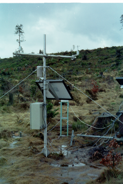
[[File: Klimastation_Freifläche_FEBRUAR97_19A.png |thumb|right|Meteorological station Duerreych catchment at clear cut site]] | [[File: Klimastation_Freifläche_FEBRUAR97_19A.png |thumb|right|Meteorological station Duerreych catchment at clear cut site]] | ||
| + | |||
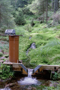
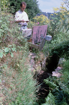
| + | [[File: PEGEL_SQ.png |thumb|right|V notch gauging station]] | ||
[[File: Ultraschallpegel_SEPTEMBER97_17A.png |thumb|right|Ultrasonic gauging station]] | [[File: Ultraschallpegel_SEPTEMBER97_17A.png |thumb|right|Ultrasonic gauging station]] | ||
Revision as of 08:50, 5 April 2016
Location
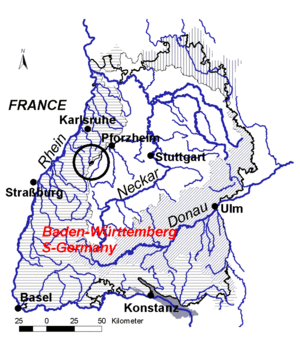
SW-Germany, Northern Black Forest
Catchment size
7 km²
Climate
humid - temperate 1500 mm/a precipitation 6-7 degree Celsius mean annual temperature
Geology
Red Sandstone / Buntsandstein
Topography
Mid moutain area, elevation 500 - 1000 m a.s.l.
Vegetation/Land use
Forest (mainly spruce)
Context of investigation
Identification of hydrological processes
Measurements/Equipment
- 1 main gauge (1974-2005)
- 2 weather stations (until 2005)
- 4 soil moisture profiles (1996-1998)
Links to project webpages
References
- Casper, M., Gemmar, P., Gronz, O., Johst, M., Stuber, M. (2007): Fuzzy logic-based rainfall-runoff modelling using soil moisture measurements to represent system state. HYDROLOGICAL SCIENCES JOURNAL-JOURNAL DES SCIENCES HYDROLOGIQUES, 52(3), 478-490.
- Casper, M.C., Volkmann, H.N., Waldenmeyer, G., Plate, E.J. (2003): The separation of flow pathways in a sandstone catchment of the Northern Black Forest using DOC and a nested Approach. PHYSICS AND CHEMISTRY OF THE EARTH , 28(6-7), 269-275.
- Casper, M.C., Volkmann, H.N., Waldenmeyer, G. (2004): Zwischenabfluss/hypodermischer Abfluss. Fallbeispiel: Einzugsgebiet des Dürreychbaches (Nordschwarzwald). In: Bronstert, A. (ed.): Prozesse der Abflussbildung, Forum für Hydrologie und Wasserbewirtschaftung, 13.05: 69-78, in German.
- Casper, M. (2002): Die Identifikation hydrologischer Prozesse im Einzugsgebiet des Dürreychbaches (Nordschwarzwald), ,Dissertation, Karlsruhe.
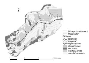
- Waldenmeyer, G., Casper, M. (2001): Identification of hydrotopes in a small forested catchment (Dürreych, Black Forest, Germany)in: Leibundgut, C., Uhlenbrook, S., McDonnell, J.J. (2001): Runoff generation and implication for river basin modelling, Freiburger Schriften zur Hydrologie, 13.
- Waldenmeyer, G. (2002): Abflussbildung und Regionalisierung in einem forstlich genutzten Einzugsgebiet (Dürreychtal, Nordschwarzwald). Diss. Universität Karlsruhe (TH). Karlsruher Schriften zur Geographie und Geoökologie, 17, Karlsruhe.
