Difference between revisions of "Weiherbach Catchment"
Jump to navigation
Jump to search
| Line 16: | Line 16: | ||
== Topography == | == Topography == | ||
| − | Gentle slopes | + | Gentle slopes, elevation: 142m-243m |
== Vegetation/Land use == | == Vegetation/Land use == | ||
Revision as of 13:58, 22 September 2010

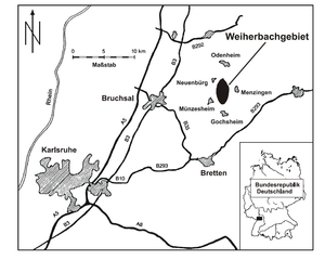
Location
Kraichgau , Germany
Catchment size
6.3 km²

Climate
semi humid, with average annual precipitation of 750-800 mm/a and average annual air temperature of 8.5°C.
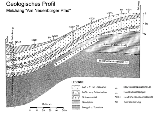
Geology
Keuper and loess layers of up to 15 m thickness

Topography
Gentle slopes, elevation: 142m-243m
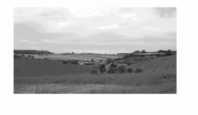
Vegetation/Land use
More then 90% of the area is used as arable land

Context of investigation
- Identification of hydrological processes
- Sediment and nutrient transport
- Pesticide leakage
- Earth worms
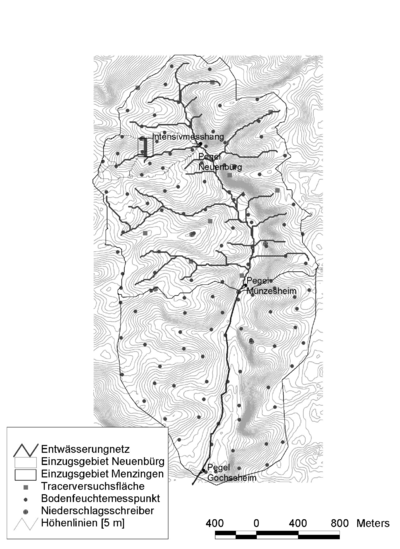
Measurements/Equipment
- Runoff
- Precipitation
- Spatial distribution of rainfall
- Meteorology
- Soil moisture
- Soil physics
- Sediment and nutrient transport