Uploads by Ban
Jump to navigation
Jump to search
This special page shows all uploaded files.
| Date | Name | Thumbnail | Size | Description | Versions |
|---|---|---|---|---|---|
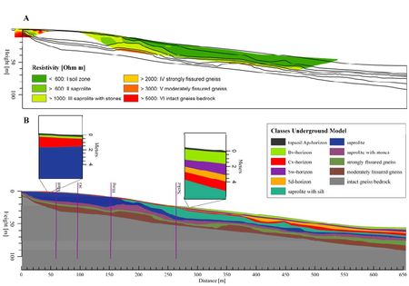
| 12:43, 3 April 2012 | ElectricalResisitivityProfileRepresentativeHillslope.jpg (file) |  |
31 KB | A: Electrical resistivity profiles Q10 (small, left) and Q12 (large, right) aligned with the representative hillslope. Black lines show the boundaries of the weathering classes. B: Underground model of the Wettzell hillslope. The surface gradient correspo | 1 |
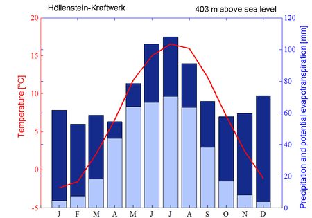
| 12:39, 3 April 2012 | ClimateChartWeatherStationHoellensteinKraftwerk.jpg (file) |  |
31 KB | Climate chart of the nearby weather station Höllenstein-Kraftwerk. The red line indicates the monthly mean temperature. Dark blue bars represent the monthly sum of precipitation; light blue bars represent monthly sums of potential evapotranspiration acco | 1 |
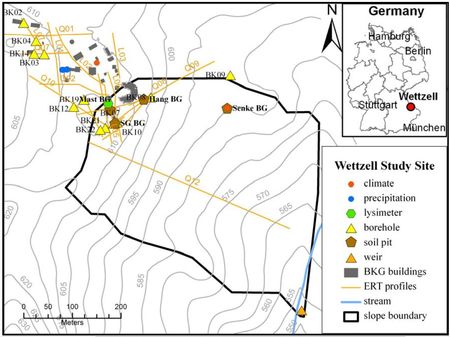
| 11:51, 3 April 2012 | HoellensteinHeadwaterCatchment.jpg (file) |  |
44 KB | 2 | |
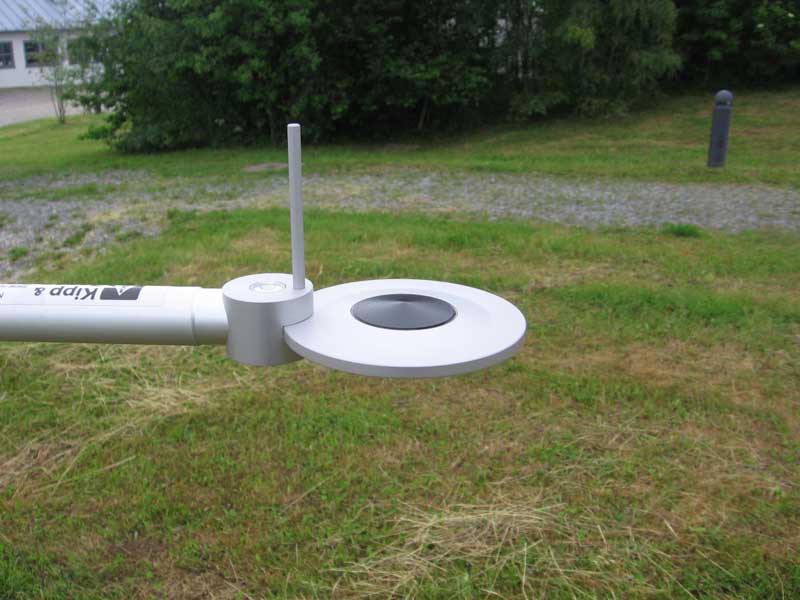
| 18:49, 9 August 2007 | Net-radiometer.jpg (file) |  |
51 KB | Net radiometer NR Lite | 1 |
| 14:42, 8 August 2007 | Ombrometer.jpg (file) |  |
27 KB | Rainfall tipping bucket | 1 |
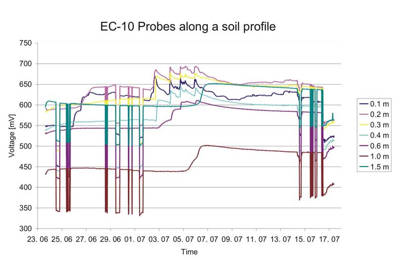
| 14:37, 8 August 2007 | ECHOProbesSoilProfile.jpg (file) |  |
39 KB | ECHO Soil Profile | 1 |
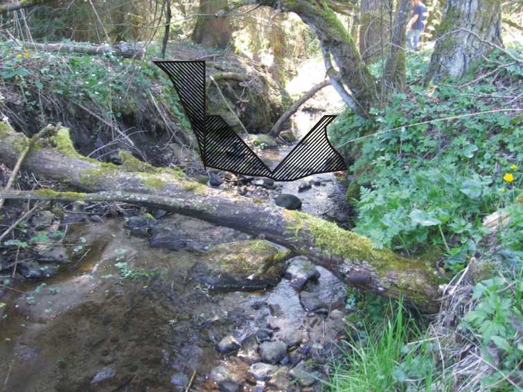
| 11:31, 8 August 2007 | VnotchWeir.jpg (file) |  |
101 KB | Construction of a V notch weir / Thomson weir | 1 |
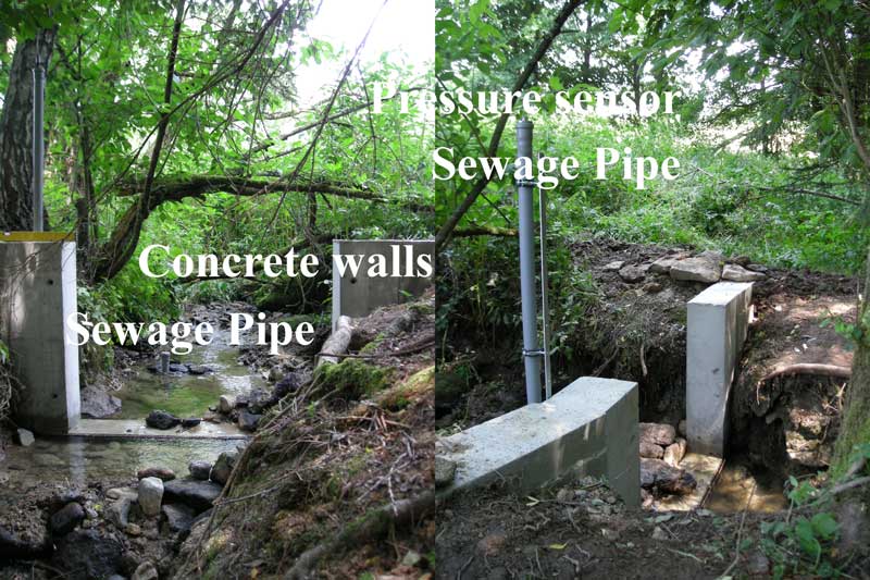
| 11:10, 8 August 2007 | WeirConcreteWallsSewagePipe.jpg (file) |  |
96 KB | Discased weir, water level sensor and sewage pipe | 1 |
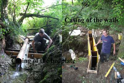
| 00:16, 8 August 2007 | WeirCasing.jpg (file) |  |
26 KB | Casing of the weir | 1 |
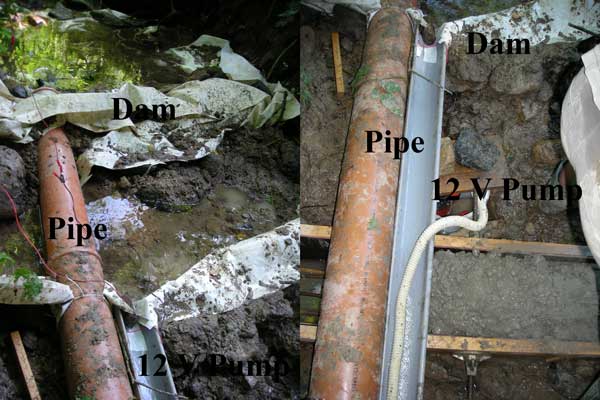
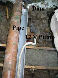
| 22:54, 7 August 2007 | WeirAccumulationDrainage.jpg (file) |  |
44 KB | Accumulation and Drainage of the Water for the weir construction | 2 |
| 22:36, 7 August 2007 | WeirAccumulationDrainage1.jpg (file) |  |
15 KB | Accumulation and Drainage of the Water | 1 |
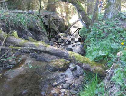
| 21:59, 7 August 2007 | WeirPlanning.jpg (file) |  |
24 KB | Planning of a v notch weir | 2 |
| 21:54, 7 August 2007 | Planning.jpg (file) |  |
75 KB | Planning of the construction of a v notch weir | 1 |