File list
Jump to navigation
Jump to search
This special page shows all uploaded files.
| Date | Name | Thumbnail | Size | User | Description | Versions |
|---|---|---|---|---|---|---|
| 13:57, 29 September 2010 | Trutrack.jpg (file) |  |
216 KB | Till | Trutrack logger (2 m) at Capella, Spain | 1 |
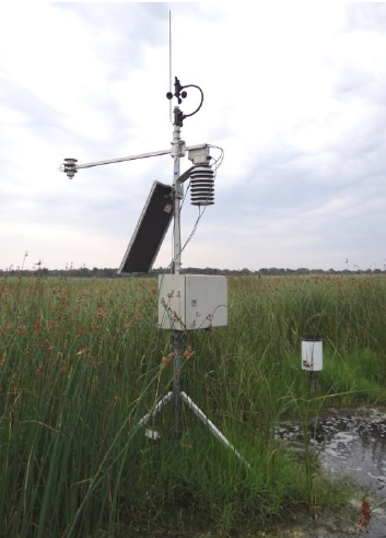
| 16:55, 8 February 2012 | HM meteorology.png (file) |  |
217 KB | Thomas | Meteorological station Hüttelmoor | 1 |
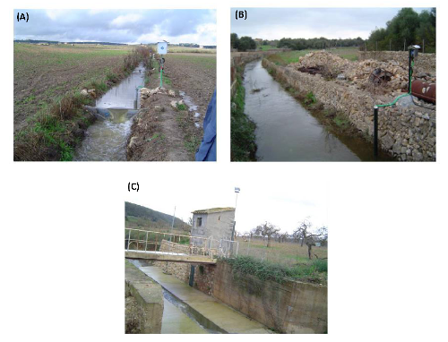
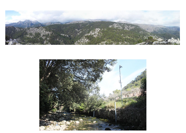
| 10:02, 18 February 2016 | Gauges of the Na Borges catchment.png (file) |  |
218 KB | Thomas | (A) An upstream view of the Can Revull (1 km2) monitoring station; (B) Downstream view of the Son Pou (142 km2) monitoring station; (C) Downstream view of the Sa Vall (264 km2) gauging station. Figure adapted from Estrany (2009) | 1 |
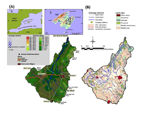
| 09:59, 18 February 2016 | Na Borges catchment.png (file) |  |
222 KB | Thomas | (A) Map of the Na Borges catchment; upset maps show: (1) Mallorca location in the Western Mediterranean, (2) Na Borges catchment location in Mallorca. (B) Main land uses at the Na Borges catchment. Figure adapted from Estrany (2009) and López-Tarazón an | 1 |
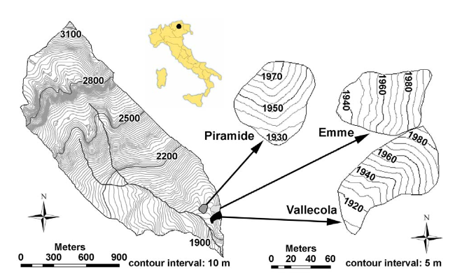
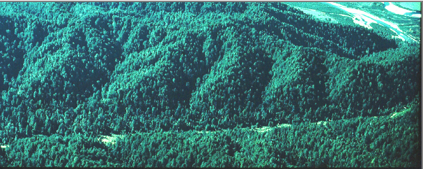
| 15:56, 12 November 2013 | Rio vauz.png (file) |  |
230 KB | Thomas | Rio Vauz catchment, Italien Alps | 1 |
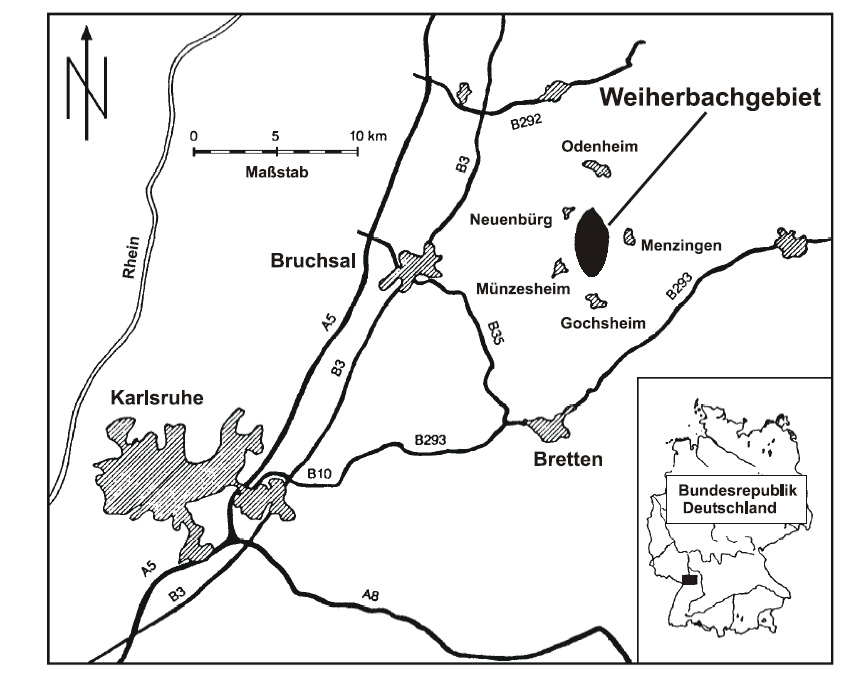
| 13:39, 22 September 2010 | Weiherbach postion.png (file) |  |
233 KB | Thomas | position of the Weiherbach catchment | 1 |
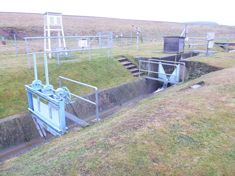
| 11:42, 10 January 2013 | Weir Schaefertalbach.JPG (file) |  |
239 KB | Thomas | V-weir of the Schäfertal with meteorological station. | 1 |
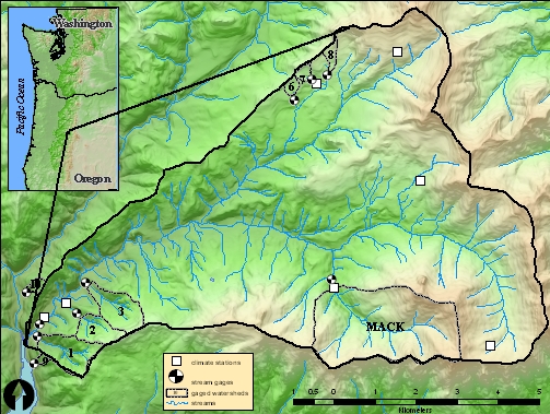
| 00:04, 10 November 2013 | HJ Andrews.jpg (file) |  |
240 KB | Thomas | Locatin of HJ Andrews Experimental Forest | 1 |
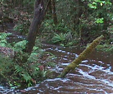
| 14:30, 6 February 2014 | Maimai stream and riparian zone.png (file) |  |
251 KB | Thomas | View on stream and riparian zone in the main catchment | 1 |
| 14:07, 19 February 2016 | Santmiquel catchment and Natura2000.png (file) |  |
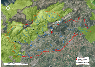
252 KB | Thomas | Delimitation of the Sant Miquel catchment. All the different gauging stations and check dams present in the catchment have been highlighted. The area included in the catchment which belongs to the Natura 2000 network has been also highlighted. | 1 |
| 08:33, 21 July 2021 | SoilVUE.jpg (file) |  |
260 KB | Till | SoilVUE10 soil moisture sensor (Campbell Sci) | 1 |
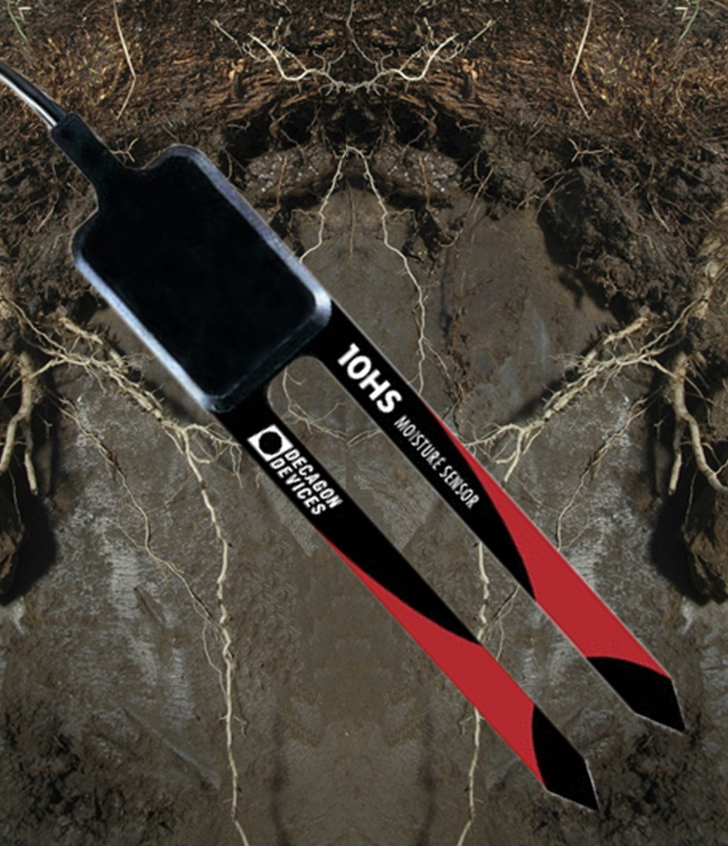
| 10:55, 9 June 2011 | Decagon 10HS.jpg (file) |  |
268 KB | Thomas | Decagon 10HS probe | 1 |
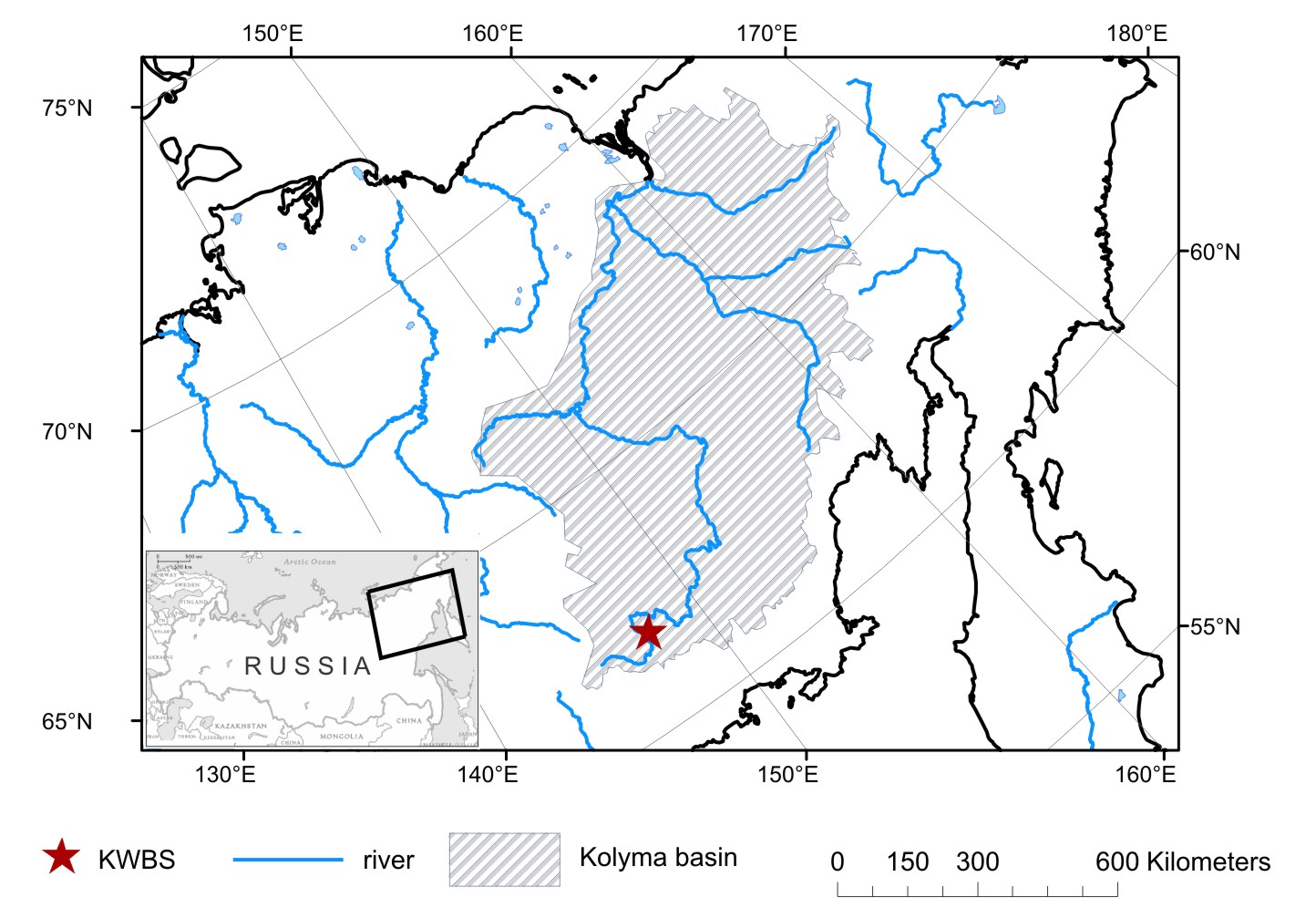
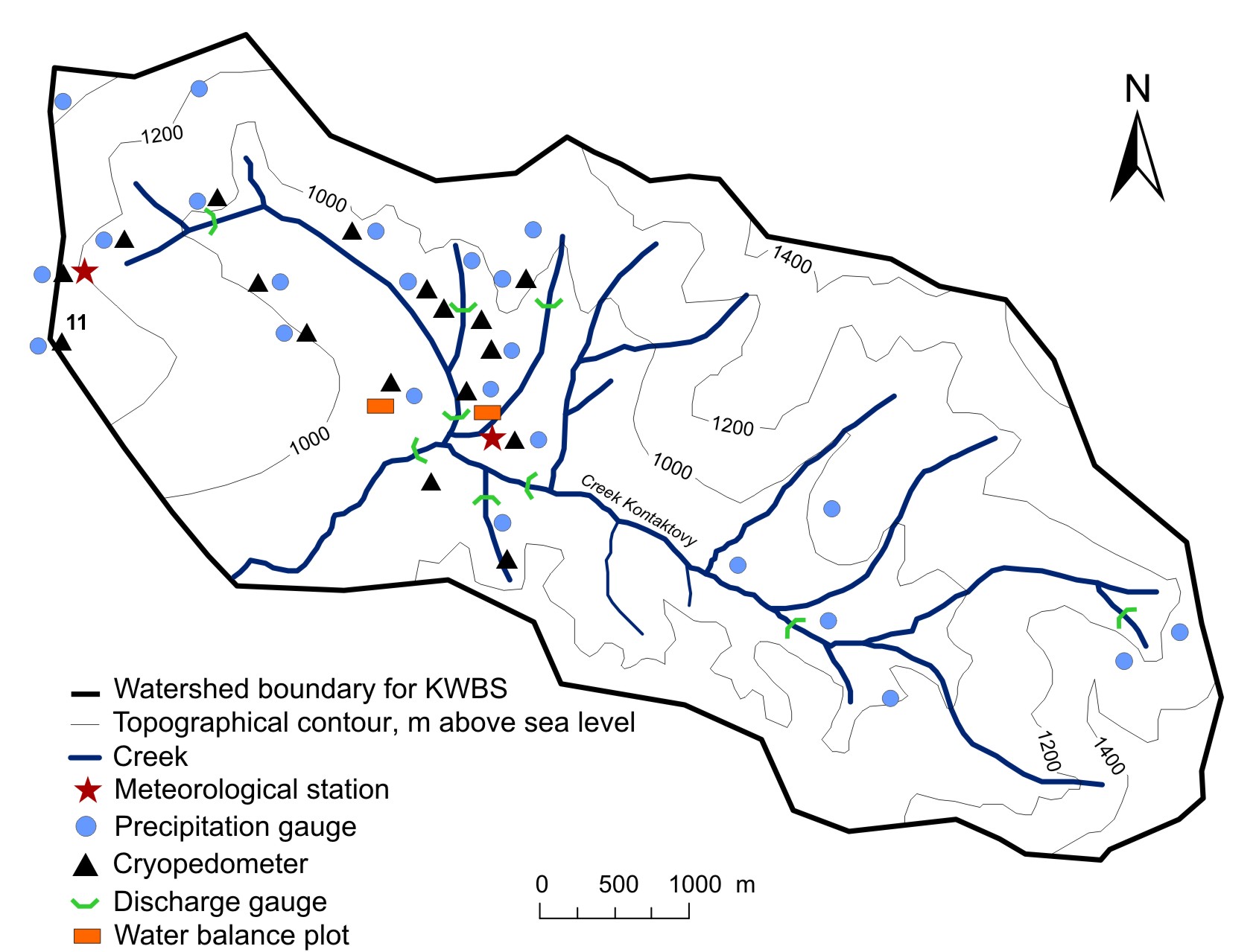
| 07:17, 27 September 2016 | KWBS location3.jpg (file) |  |
268 KB | Mila Lebedeva | 1 | |
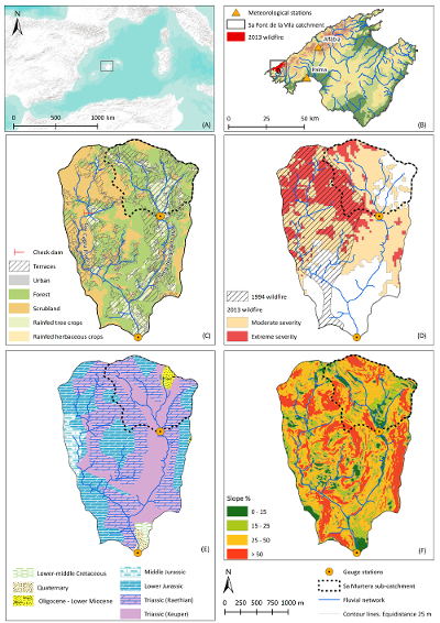
| 14:01, 19 February 2016 | Sa Font de la Vila catchment.jpg (file) |  |
269 KB | Thomas | A) Location of Palma within the Mediterranean; B) Location of the Sa Font de la Vila catchment within the island of Mallorca; C) Main Landuses; D) Affectation of the 1994 and 2013 wildfires; E) Main geological units; F) Map of slopes. | 1 |
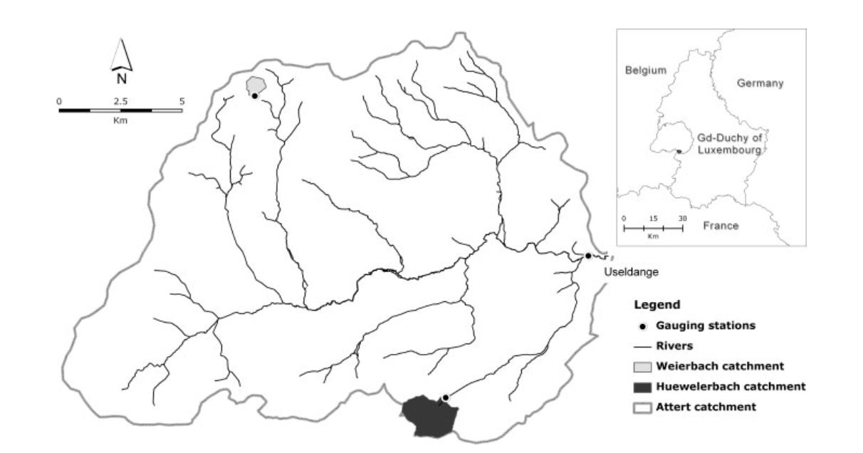
| 22:56, 9 November 2013 | Attert catchment.png (file) |  |
270 KB | Thomas | Attert catchment Luxembourg | 1 |
| 13:32, 6 February 2012 | Areal view Schaefertal.png (file) |  |
273 KB | Thomas | areal view Schäfertal catchment | 1 |
| 07:26, 27 September 2016 | KWBS - scheme2.jpg (file) |  |
273 KB | Mila Lebedeva | 1 | |
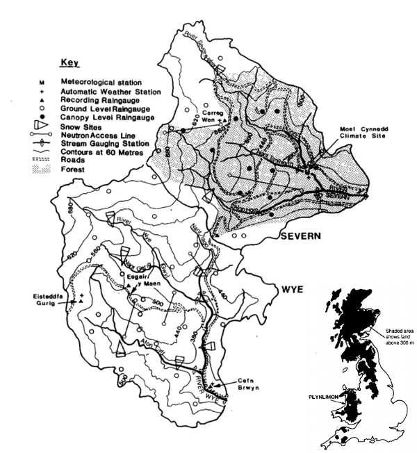
| 12:47, 17 February 2016 | Plynlimon X.png (file) |  |
275 KB | Thomas | Plynlimon catchments, Wales, UK | 1 |
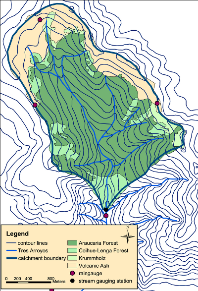
| 17:18, 9 February 2012 | Mapkl.png (file) |  |
276 KB | Thomas | Malalcahuello catchment Chile | 1 |
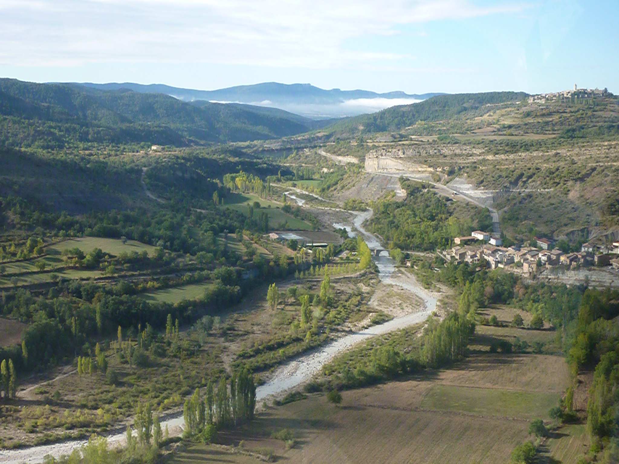
| 17:11, 4 February 2013 | LaPueblaDeRoda.JPG (file) |  |
279 KB | Jmigueldelgado | Aerial view of the Isábena River near Puebla de Roda. Credits to Sandra Werb. | 1 |
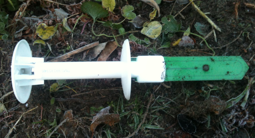
| 10:43, 25 November 2013 | Tms probe.png (file) |  |
280 KB | Thomas | 1 | |
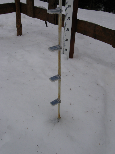
| 13:19, 6 February 2012 | HOBO snow.png (file) |  |
281 KB | Thomas | Snow hight via temperature | 1 |
| 14:09, 19 February 2016 | SantMiquel gauging stations.png (file) |  |
284 KB | Thomas | Delimitation of the Sant Miquel catchment. All the different gauging stations and check dams present in the catchment have been highlighted. The area included in the catchment which belongs to the Natura 2000 network has been also highlighted. | 1 |
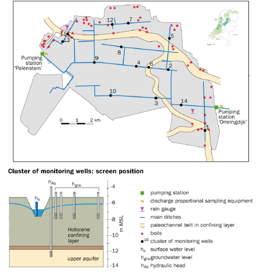
| 16:30, 15 April 2014 | Noordplas Polder.png (file) |  |
286 KB | Thomas | Noordplas Polder drainage area after de Louw et al. 2011, modified | 1 |
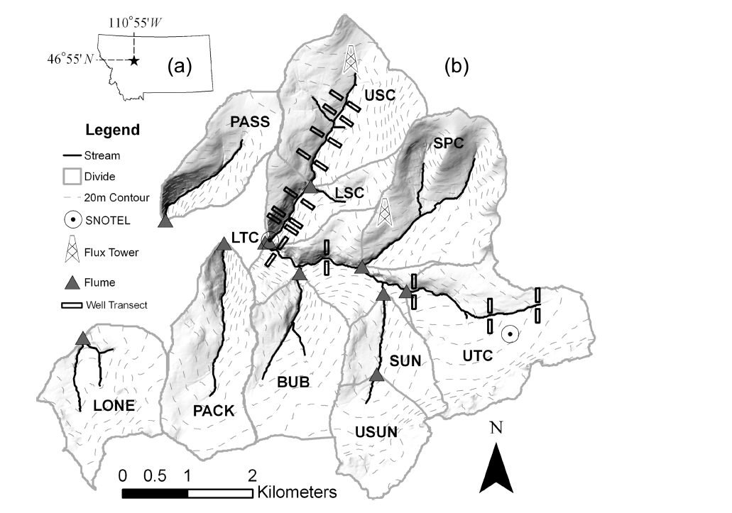
| 14:49, 9 April 2014 | Tenderfoot experimental Watershed.png (file) |  |
290 KB | Thomas | Tendefoot experimental watershed after Jencso et al. 2011 | 1 |
| 16:57, 8 February 2012 | HM chamber.png (file) |  |
292 KB | Thomas | Chamber measurment of CH4 | 1 |
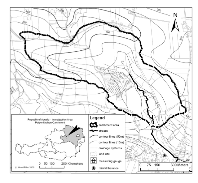
| 13:20, 7 November 2013 | HOAL.png (file) |  |
292 KB | Thomas | Catchment HOAL | 1 |
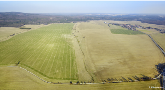
| 17:42, 6 February 2015 | Birdseye.png (file) |  |
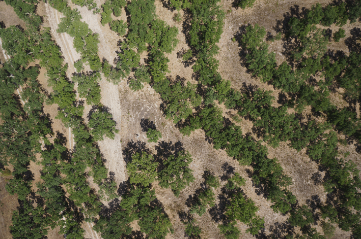
298 KB | Jmigueldelgado | Photo from UAV taken in June 2014 of a part of the experimental plot at Machuqueira do Grou. | 1 |
| 17:17, 6 October 2010 | Weiherbach catena.png (file) |  |
329 KB | Theresa | 2 | |
| 13:41, 6 February 2014 | Maimai areal view.png (file) |  |
391 KB | Thomas | areal view into the MaiMai catchments by Lindsay Rowe | 1 |
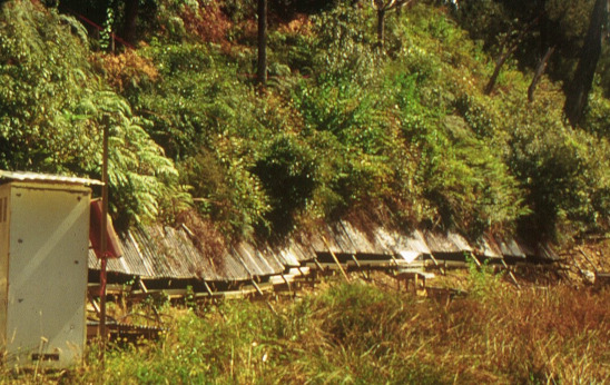
| 14:31, 6 February 2014 | Maimai throughfall trench.png (file) |  |
401 KB | Thomas | Hillslope throughfall trench | 1 |
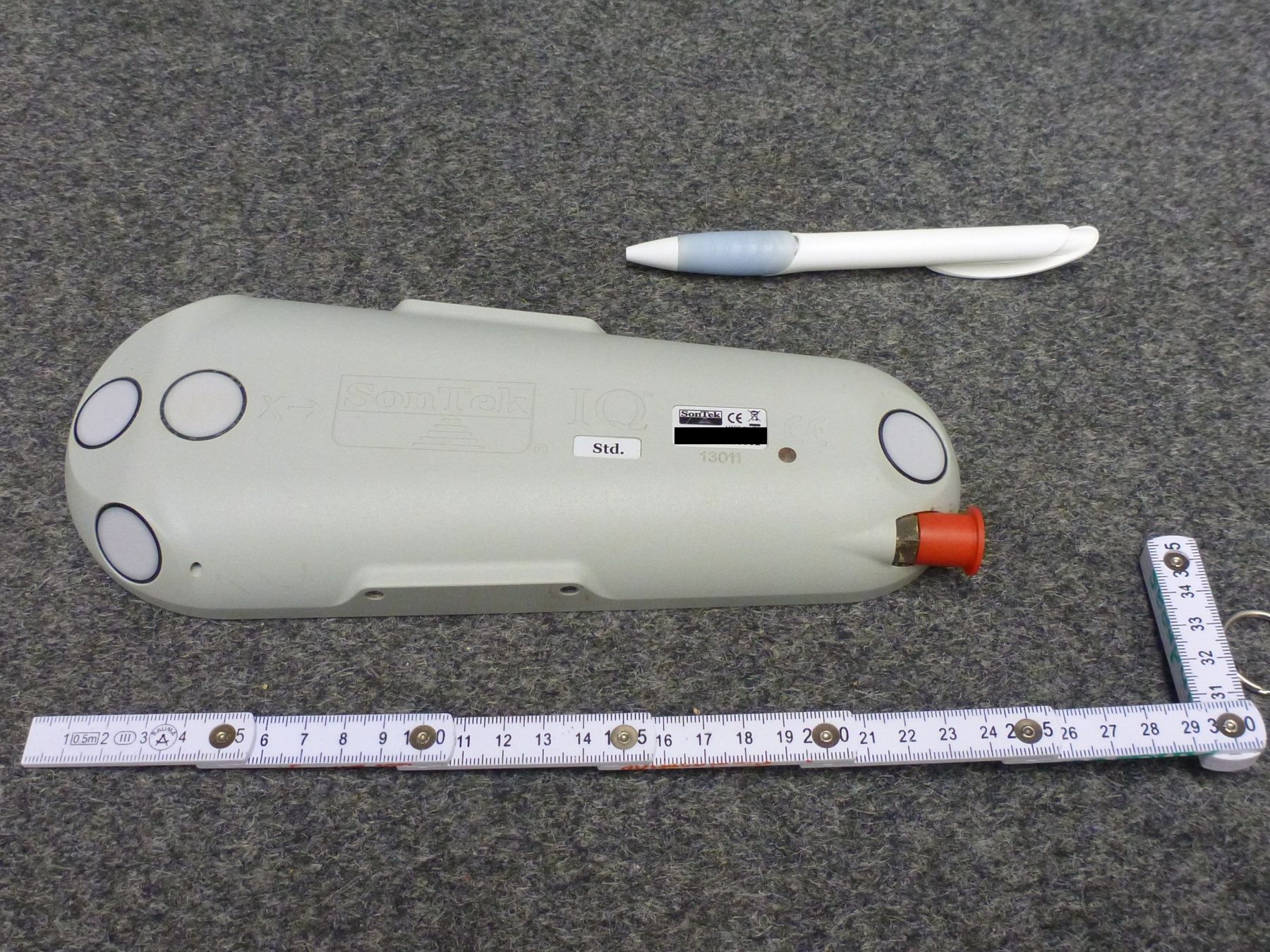
| 12:18, 17 July 2015 | Sontekiq.jpg (file) |  |
499 KB | Till | Sontek IQ Standard for continuous discharge measurement. The red cap covers the plug that is needed for power supply and data download. | 1 |
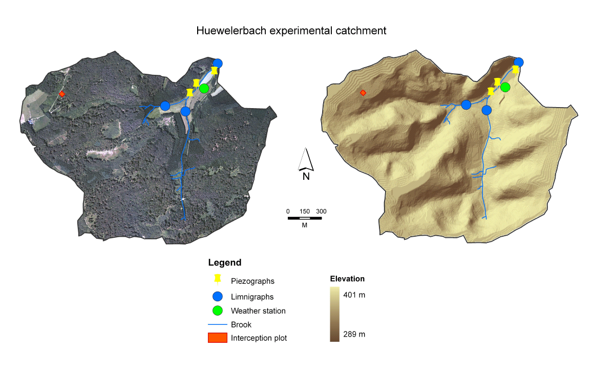
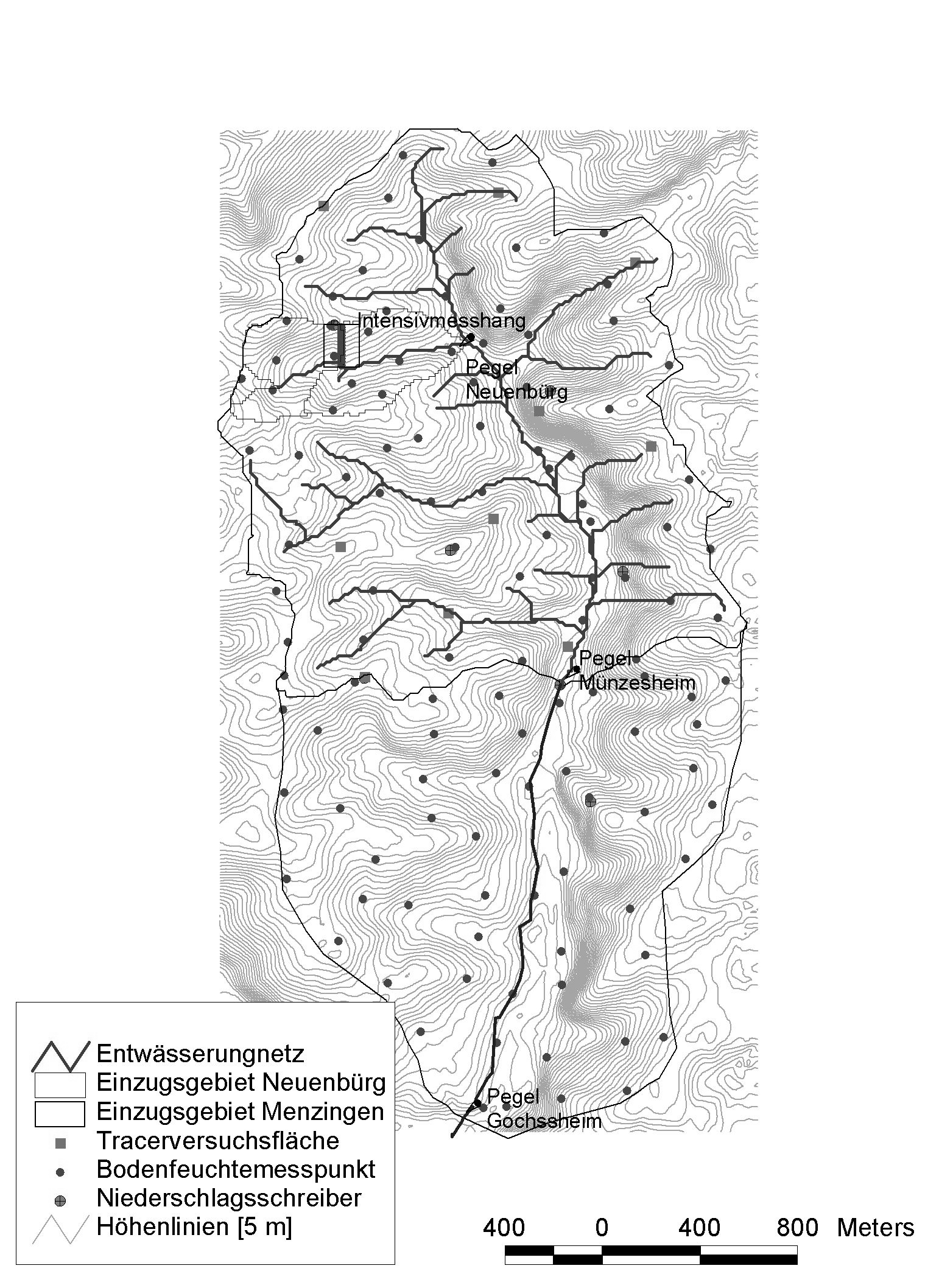
| 11:39, 8 November 2013 | Catchment Huewellebach.png (file) |  |
561 KB | Thomas | Huewellebach catchment with channel network and devices | 1 |
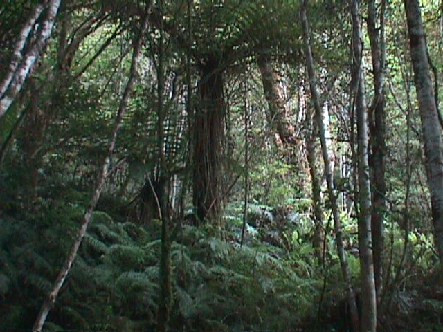
| 14:31, 6 February 2014 | Maimai vegetation patterns.png (file) |  |
581 KB | Thomas | Typical vegetation in the MaiMai catchment | 1 |
| 12:25, 22 September 2010 | Schaefertal borchardt catchment.png (file) |  |
582 KB | Thomas | View of the catchment Schaefertal after Borchardt, 1982 | 1 |
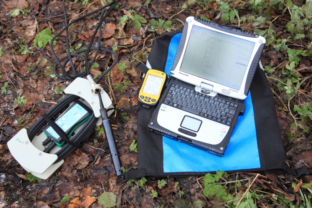
| 17:10, 27 November 2013 | TQ system fluorimeter.jpg (file) |  |
620 KB | Till | TQ-System with fluorescence sensor, PDA (Trimble Juno) and laptop (Panasonic Toughbook) | 1 |
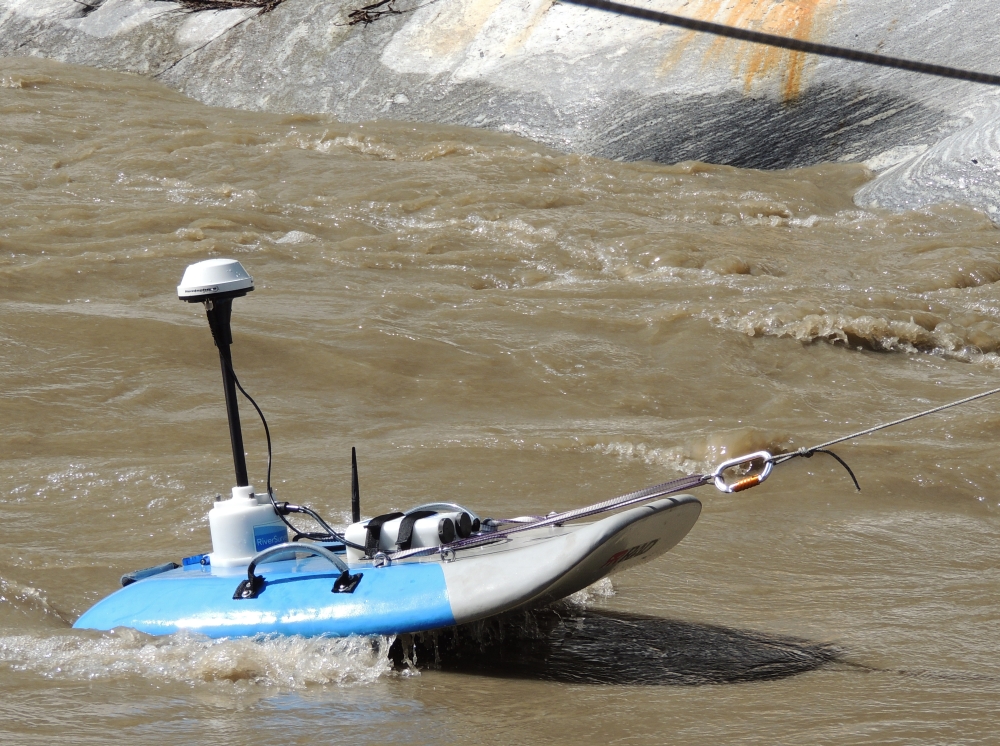
| 16:54, 28 April 2014 | Riv surv marginal.JPG (file) |  |
668 KB | Till | M9 RiverSurveyor under marginal conditions (pitch) | 1 |
| 13:47, 22 September 2010 | Weiherbach landscape.png (file) |  |
690 KB | Thomas | view of the landscape in the Weiherbach | 1 |
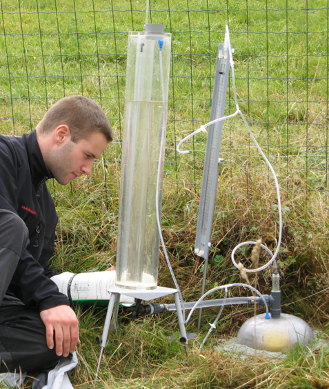
| 18:15, 18 December 2008 | Hood infiltometer.png (file) |  |
741 KB | Thomas | Hood Infiltrometer | 1 |
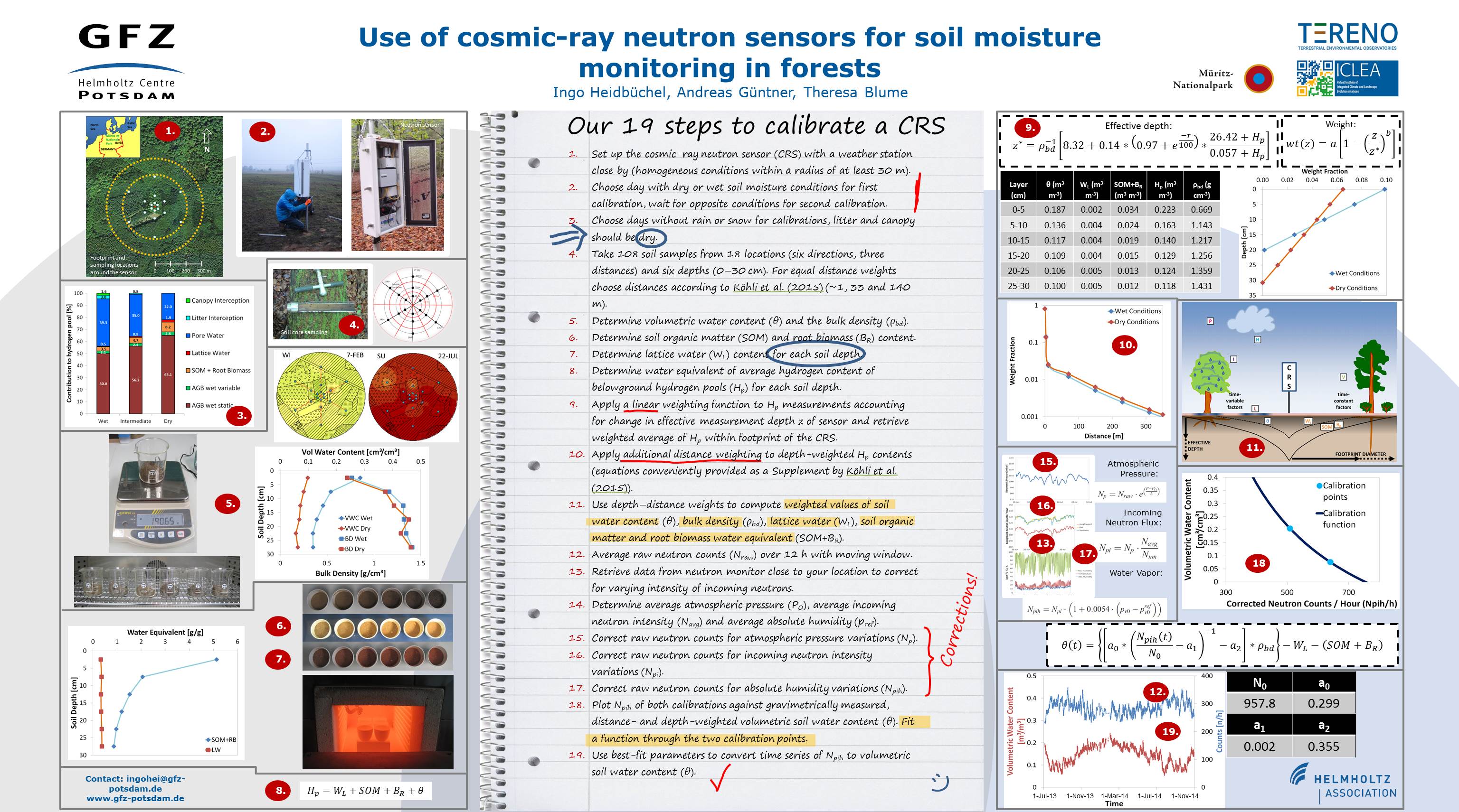
| 17:47, 6 May 2016 | CosmicCalibration.jpg (file) |  |
746 KB | Ingohei | 1 | |
| 13:51, 22 September 2010 | Weiherbach catchment.png (file) |  |
842 KB | Thomas | watershed and rivernetwork of the Weiherbach | 1 |
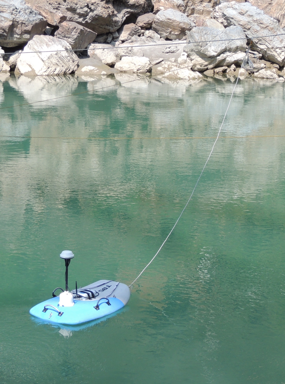
| 16:52, 28 April 2014 | Riv surv calm.JPG (file) |  |
1.02 MB | Till | Tethered RiverSurveyor in calm water. | 1 |
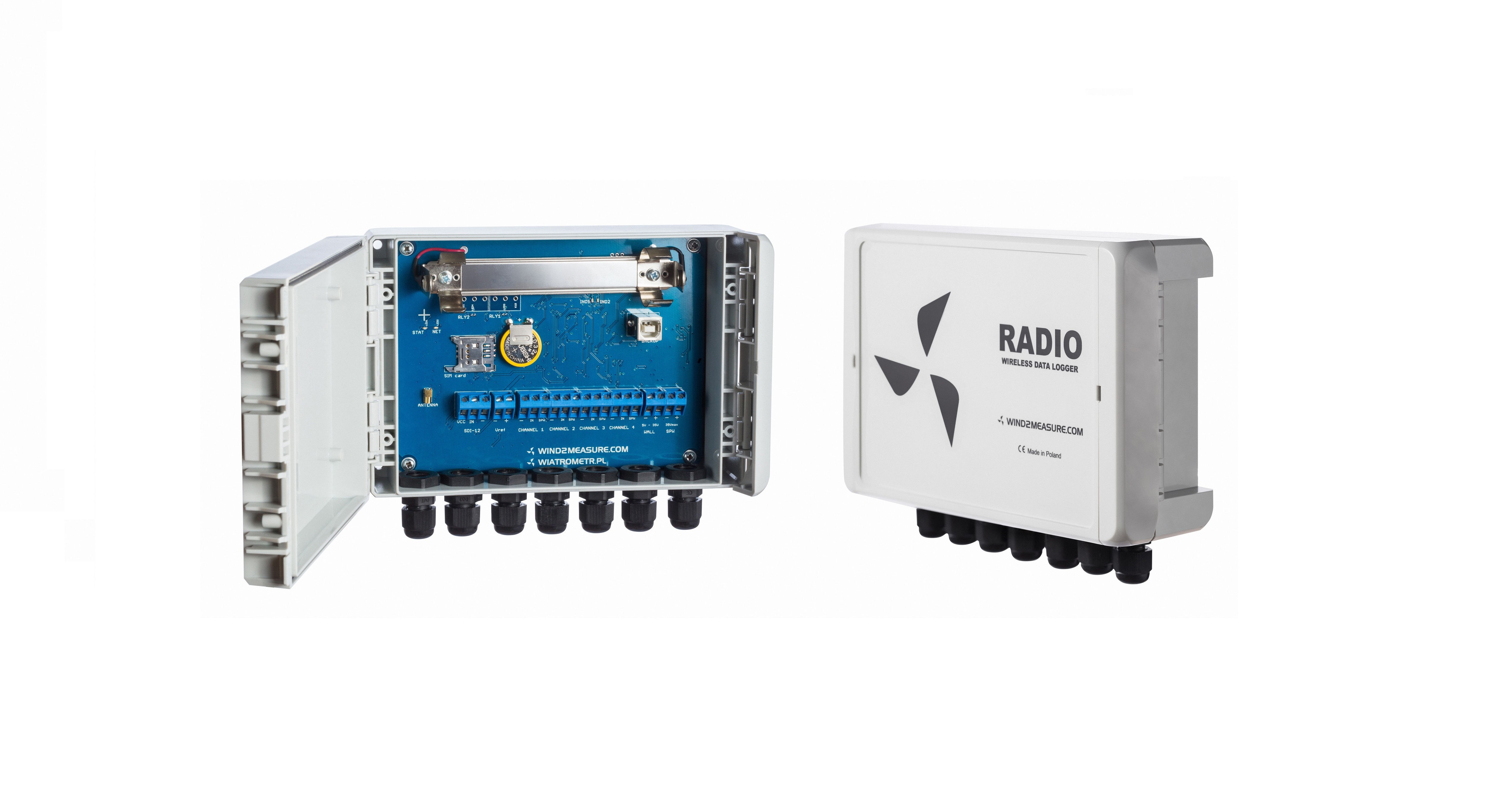
| 11:25, 3 August 2016 | Radiox2 (2).jpg (file) | .jpg) |
1.23 MB | Wind2measure | 1 | |
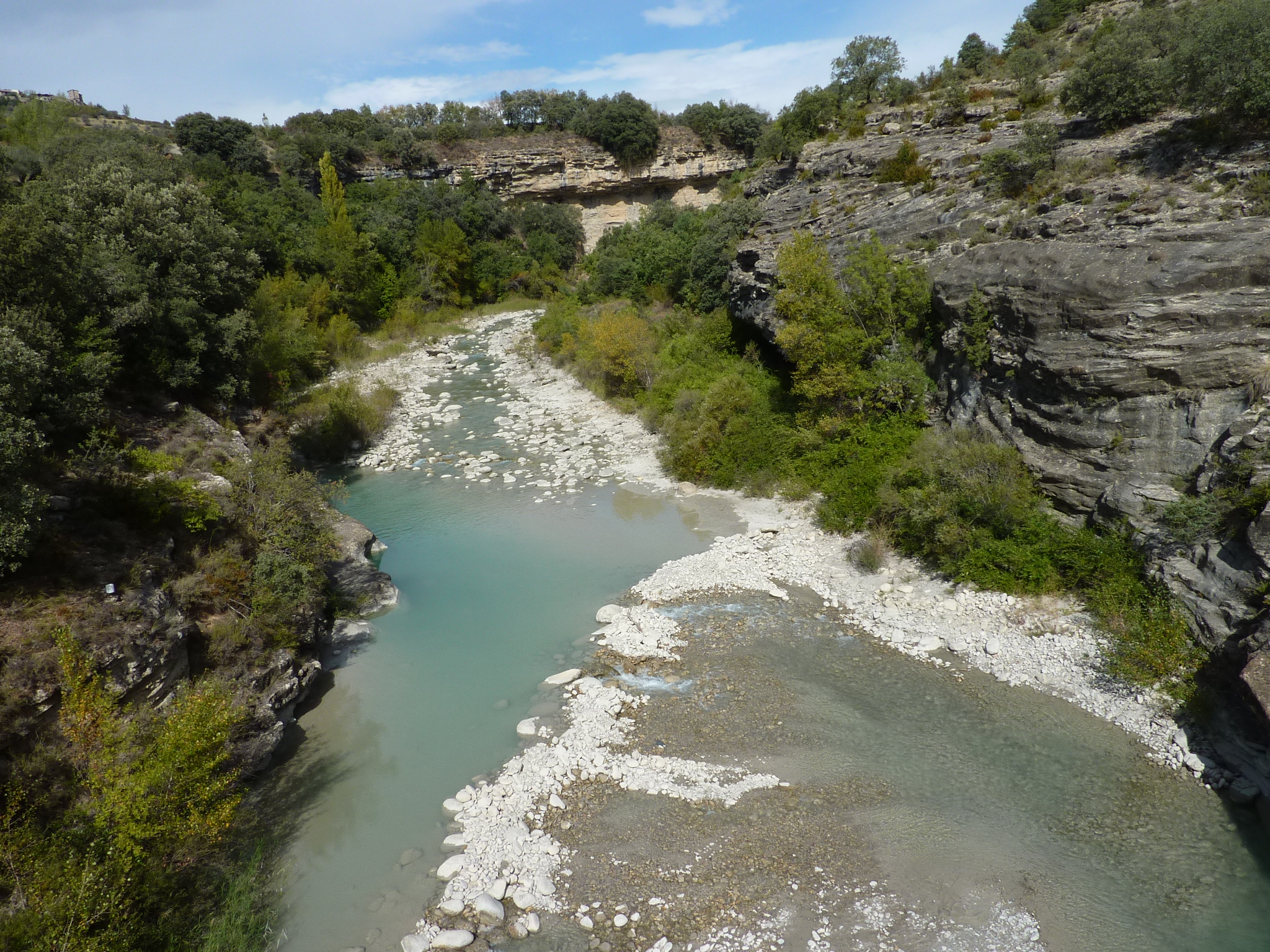
| 17:17, 4 February 2013 | P1050772.JPG (file) |  |
1.57 MB | Jmigueldelgado | Isábena River. Credits to Sandra Werb. | 1 |
| 17:11, 6 May 2016 | CosmicCalibration.pdf (file) | 1.65 MB | Ingohei | 1 | ||
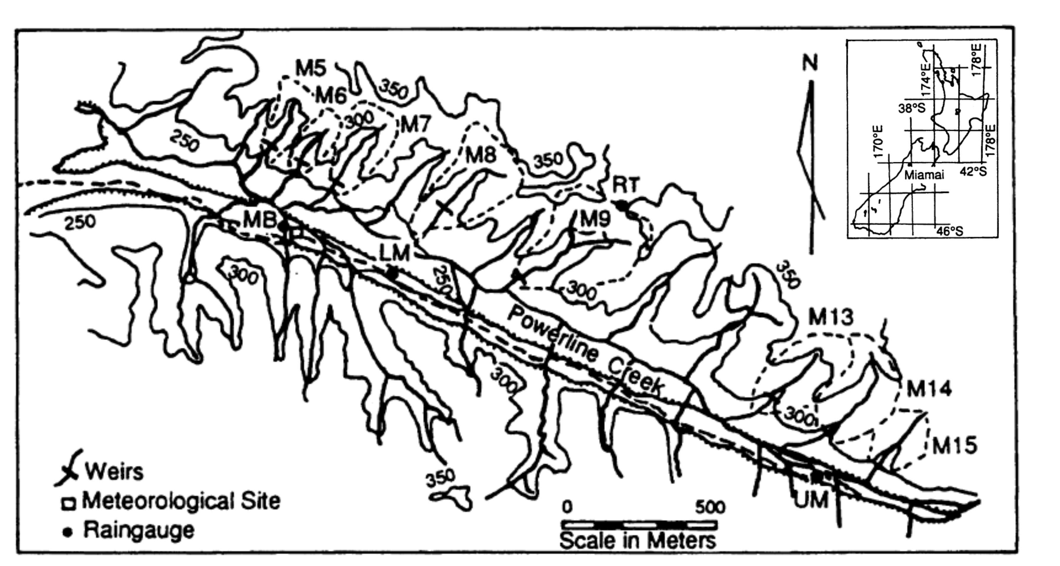
| 11:39, 14 November 2013 | Maimai 2.png (file) |  |
1.94 MB | Thomas | Experimental catchments of MaiMai New Zealand | 1 |
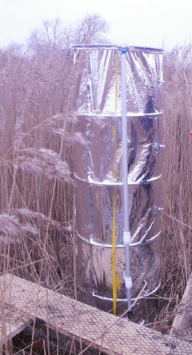
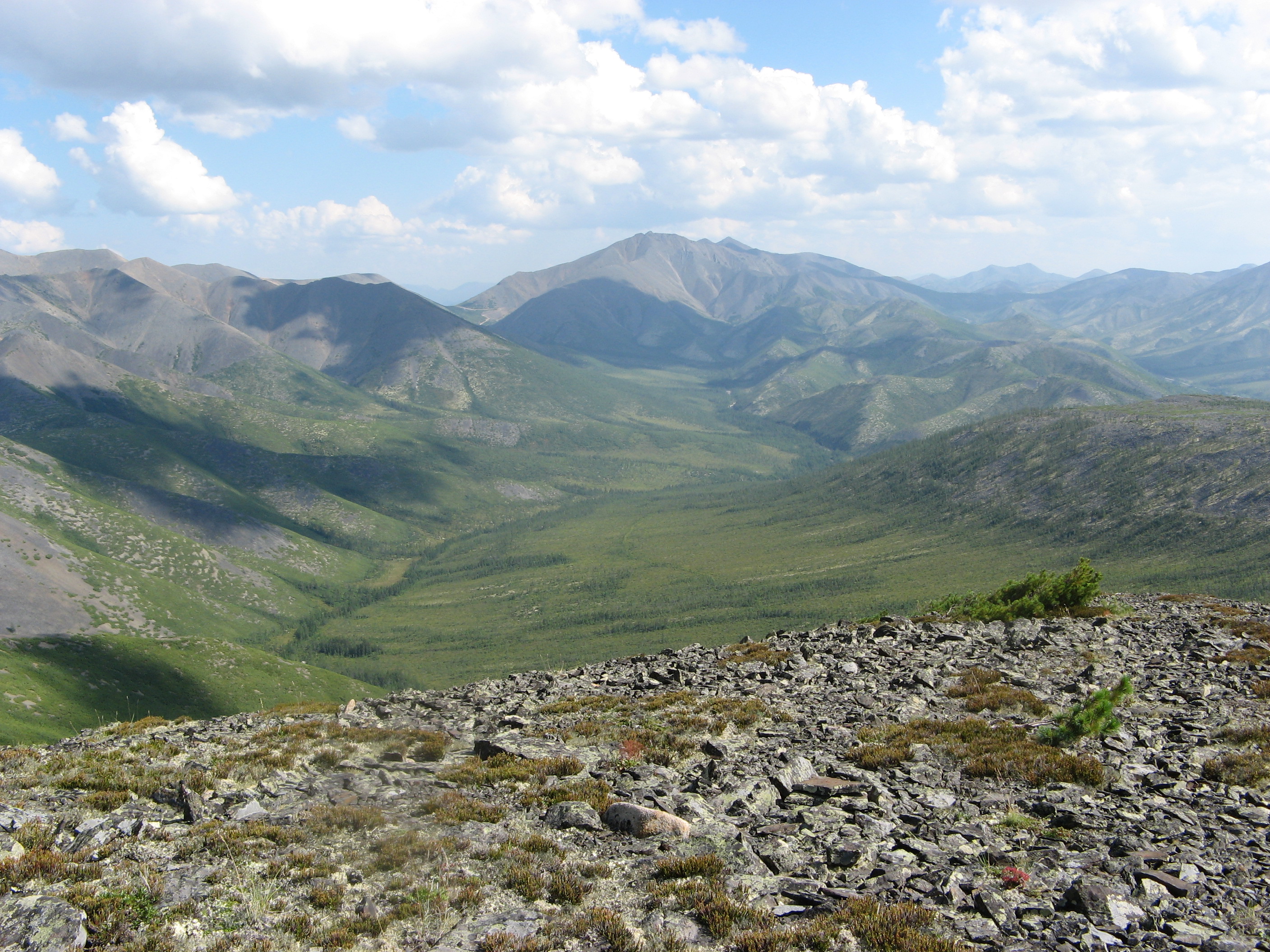
| 07:29, 27 September 2016 | Kolyma water-balance station 2016.JPG (file) |  |
2.03 MB | Mila Lebedeva | by L.Lebedeva | 1 |
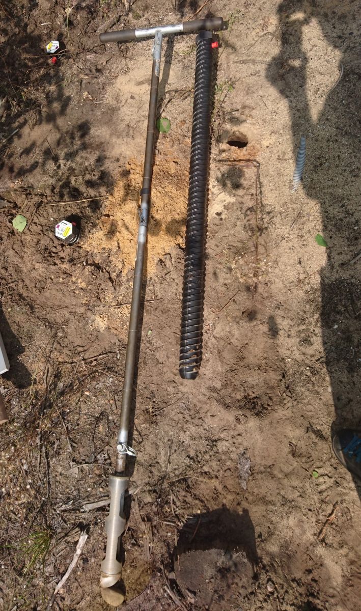
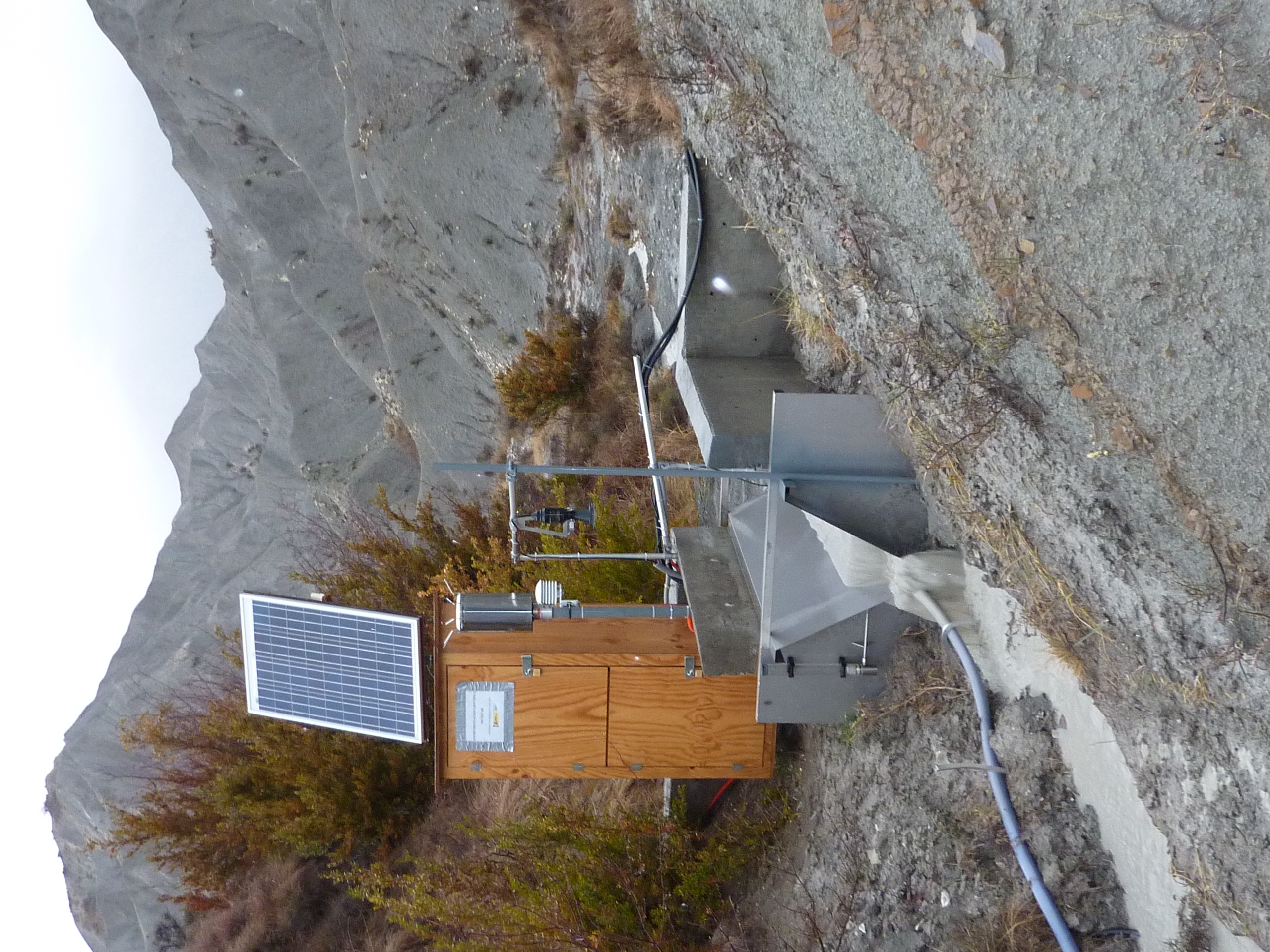
| 07:50, 27 September 2016 | Kolyma water-balance station 2016 rocky talus.JPG (file) |  |
3.04 MB | Mila Lebedeva | 1 | |
| 17:22, 4 February 2013 | P1030849.JPG (file) |  |
3.4 MB | Jmigueldelgado | Experimental setup measuring the outflow from subcatchment dominated by badlands. | 1 |
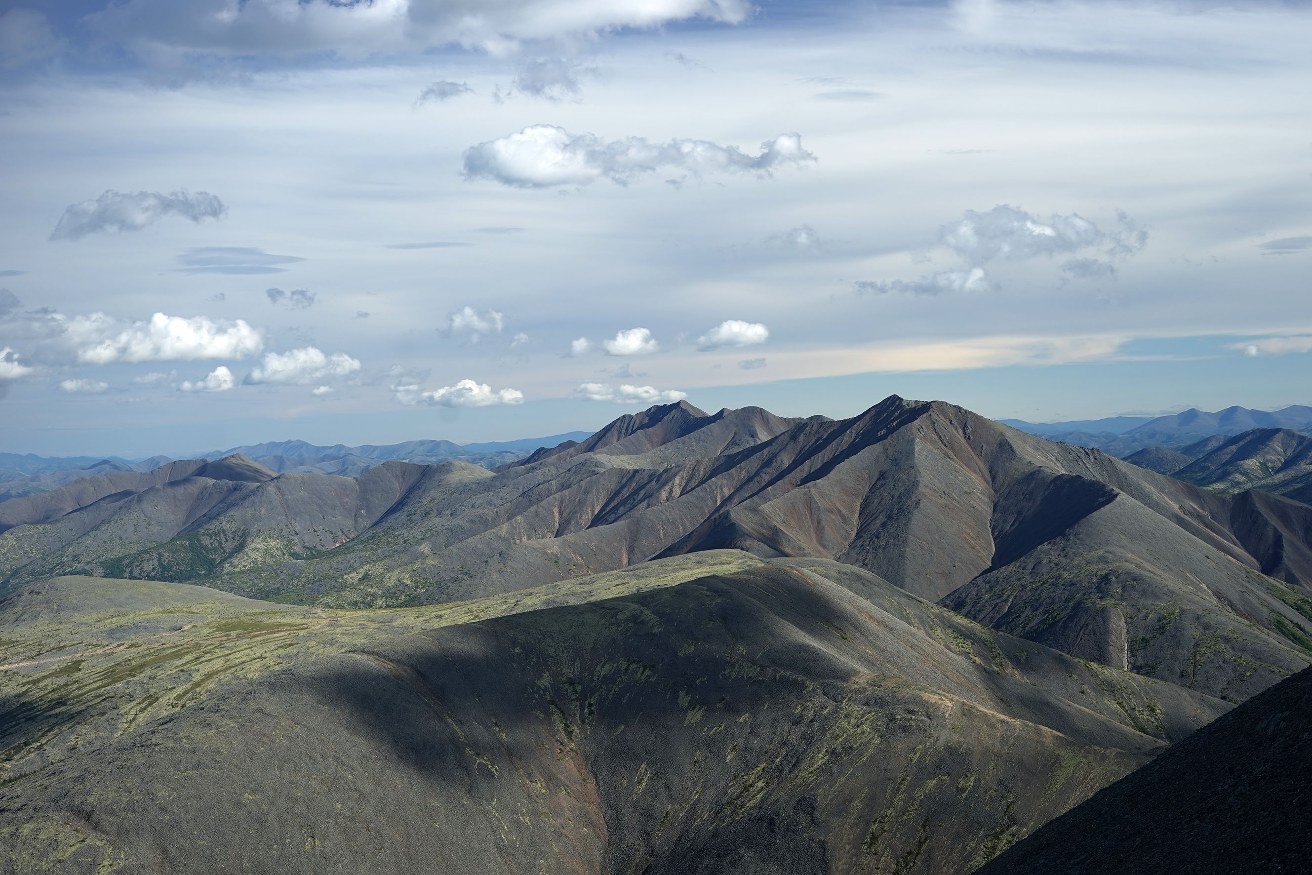
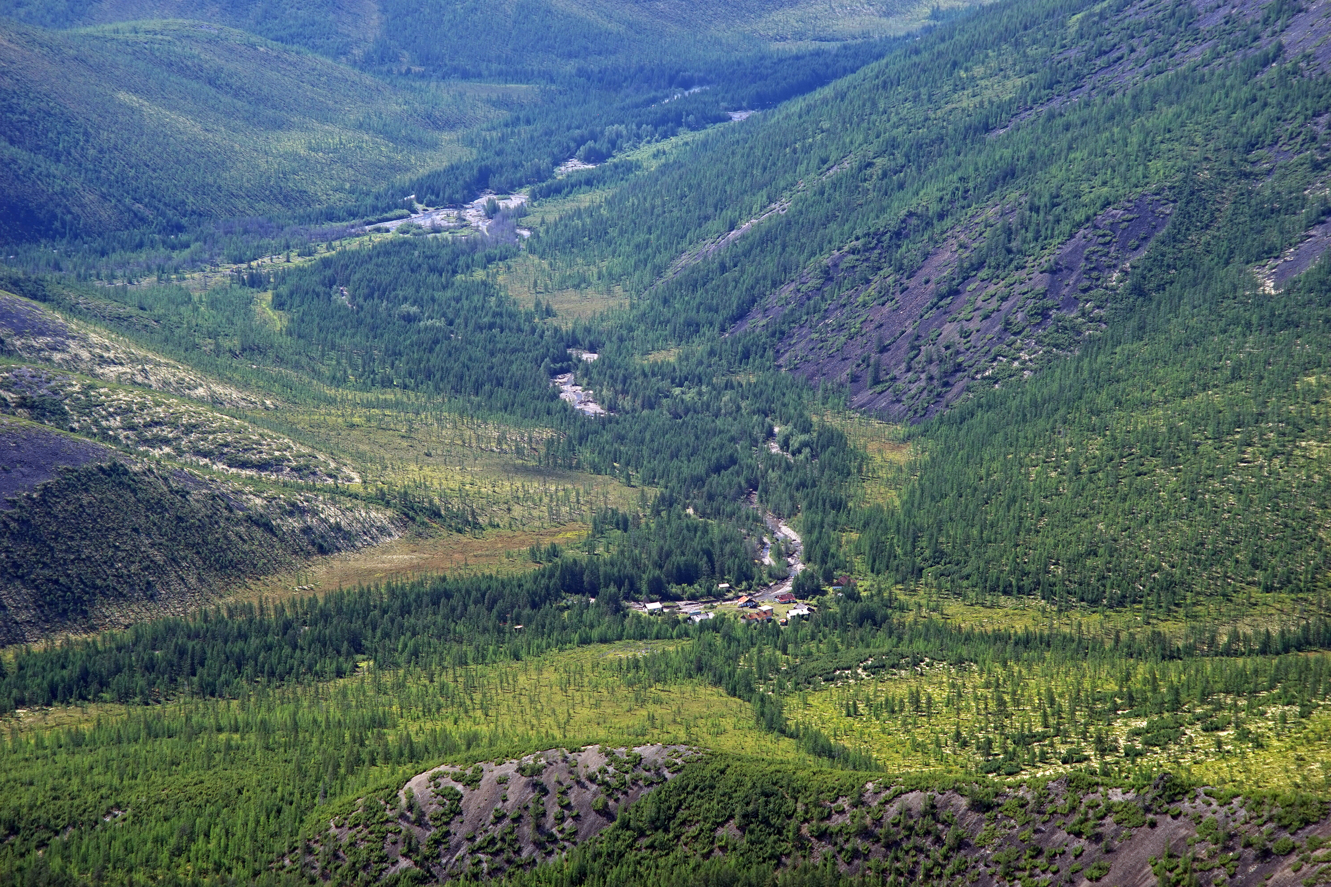
| 07:49, 27 September 2016 | Kolyma water-balance station 2016 river valley.jpg (file) |  |
5.62 MB | Mila Lebedeva | 1 |