File list
Jump to navigation
Jump to search
This special page shows all uploaded files.
| Date | Name | Thumbnail | Size | User | Description | Versions |
|---|---|---|---|---|---|---|
| 11:31, 8 November 2013 | X.png (file) |  |
156 KB | Thomas | 1 | |
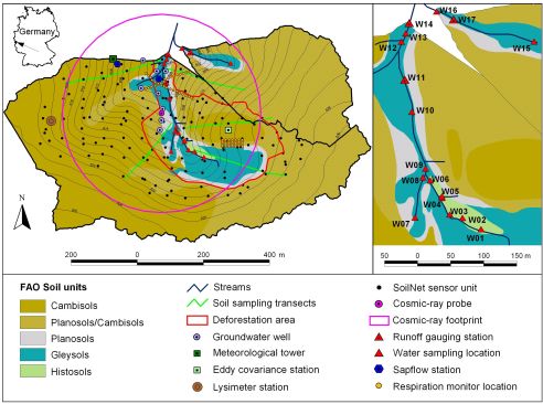
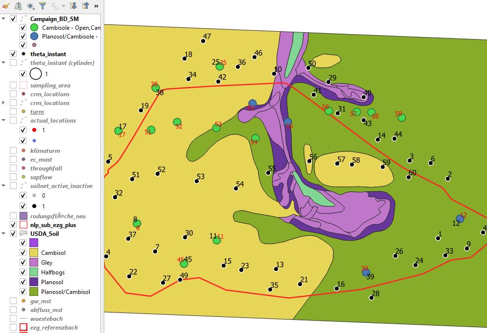
| 12:24, 9 September 2016 | Wüstebach map.jpg (file) |  |
46 KB | Bogena | Map showing the soil types and monitoring instrumentation of the Wüstebach catchment | 2 |
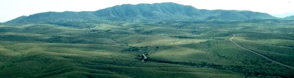
| 23:20, 9 November 2013 | Wng.jpg (file) | 19 KB | Thomas | View into the Walnut Gulch Experimental Watershed | 1 | |
| 12:16, 25 July 2007 | Wiki interception.pdf (file) | 82 KB | Savenije | Text for Article on Interception | 1 | |
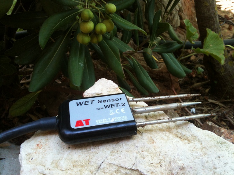
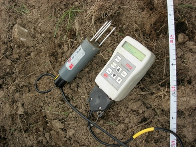
| 12:49, 17 October 2012 | Wetsensor.jpg (file) |  |
190 KB | Thomas | detail image of the delta t Wet sensor | 1 |
| 10:43, 9 June 2011 | Wetsensor.gif (file) |  |
15 KB | Thomas | delta t wet sensor | 1 |
| 13:46, 8 March 2007 | Westerbork setup2.jpg (file) |  |
42 KB | Miriam Gerrits | 1 | |
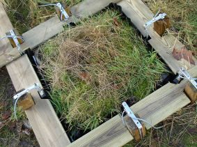
| 15:48, 3 August 2010 | Weißeritz Wiki.jpg (file) |  |
41 KB | Janek Dreibrodt | 2 | |
| 15:34, 3 August 2010 | Weißeritz Wiki.JPG (file) |  |
75 KB | Janek Dreibrodt | 1 | |
| 11:42, 10 January 2013 | Weir Schaefertalbach.JPG (file) |  |
239 KB | Thomas | V-weir of the Schäfertal with meteorological station. | 1 |
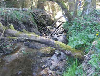
| 21:59, 7 August 2007 | WeirPlanning.jpg (file) |  |
24 KB | Ban | Planning of a v notch weir | 2 |
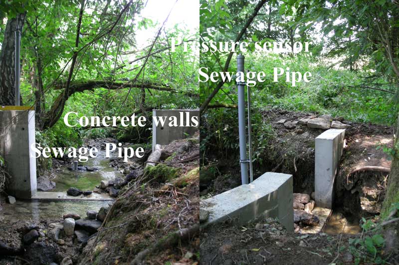
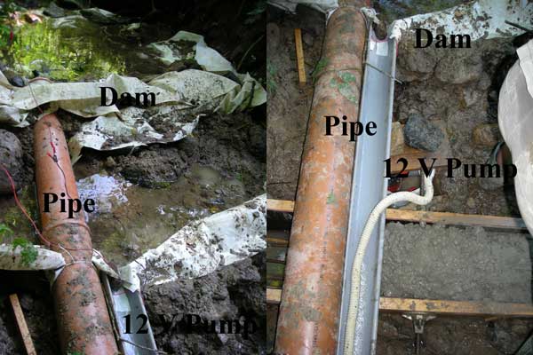
| 11:10, 8 August 2007 | WeirConcreteWallsSewagePipe.jpg (file) |  |
96 KB | Ban | Discased weir, water level sensor and sewage pipe | 1 |
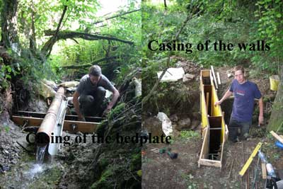
| 00:16, 8 August 2007 | WeirCasing.jpg (file) |  |
26 KB | Ban | Casing of the weir | 1 |
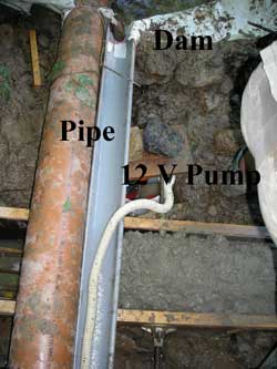
| 22:36, 7 August 2007 | WeirAccumulationDrainage1.jpg (file) |  |
15 KB | Ban | Accumulation and Drainage of the Water | 1 |
| 22:54, 7 August 2007 | WeirAccumulationDrainage.jpg (file) |  |
44 KB | Ban | Accumulation and Drainage of the Water for the weir construction | 2 |
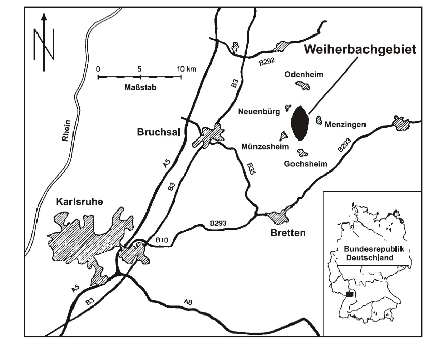
| 13:39, 22 September 2010 | Weiherbach postion.png (file) |  |
233 KB | Thomas | position of the Weiherbach catchment | 1 |
| 13:47, 22 September 2010 | Weiherbach landscape.png (file) |  |
690 KB | Thomas | view of the landscape in the Weiherbach | 1 |
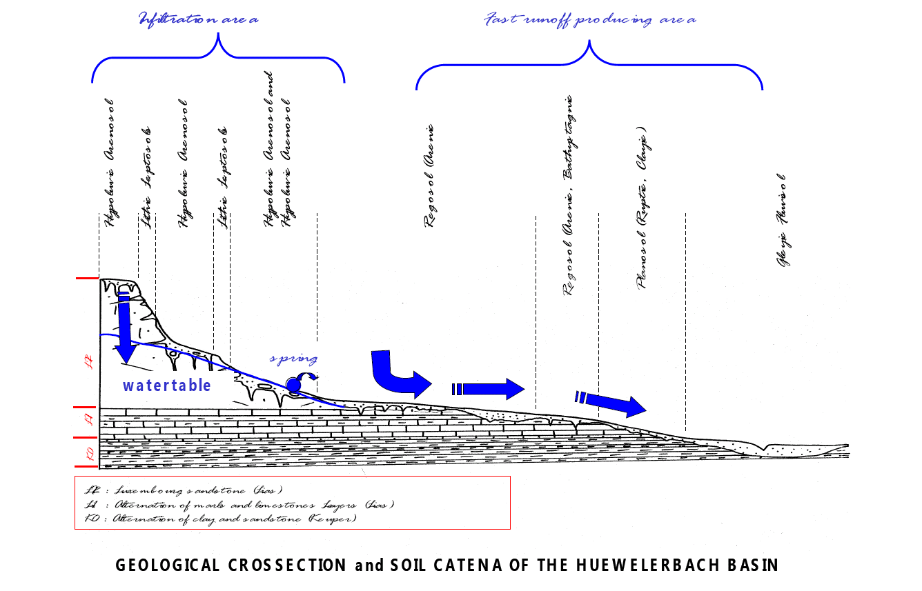
| 17:17, 6 October 2010 | Weiherbach catena.png (file) |  |
329 KB | Theresa | 2 | |
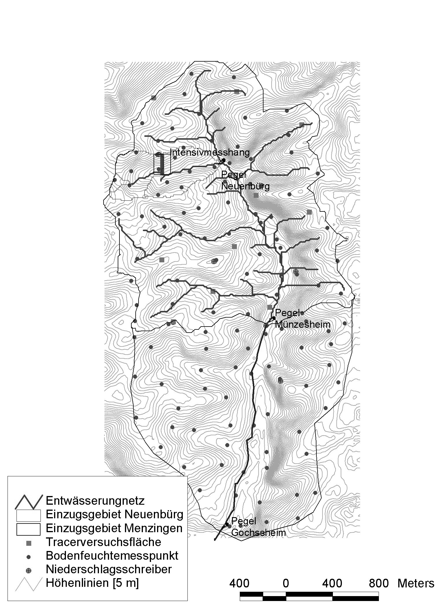
| 13:51, 22 September 2010 | Weiherbach catchment.png (file) |  |
842 KB | Thomas | watershed and rivernetwork of the Weiherbach | 1 |
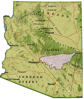
| 23:36, 9 November 2013 | WalnutGulch Map.jpg (file) |  |
36 KB | Thomas | Location of the Walnut Gulch Experimental Watershed, Arizona, USA | 1 |
| 11:31, 8 August 2007 | VnotchWeir.jpg (file) |  |
101 KB | Ban | Construction of a V notch weir / Thomson weir | 1 |
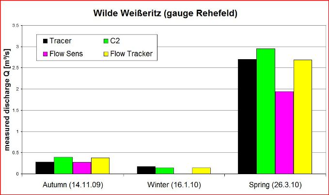
| 15:24, 3 August 2010 | Vgl Messmeth Jahresz WW.pdf (file) | 5 KB | Janek Dreibrodt | 1 | ||
| 15:23, 3 August 2010 | Vgl Messmeth Jahresz BB.pdf (file) | 5 KB | Janek Dreibrodt | 1 | ||
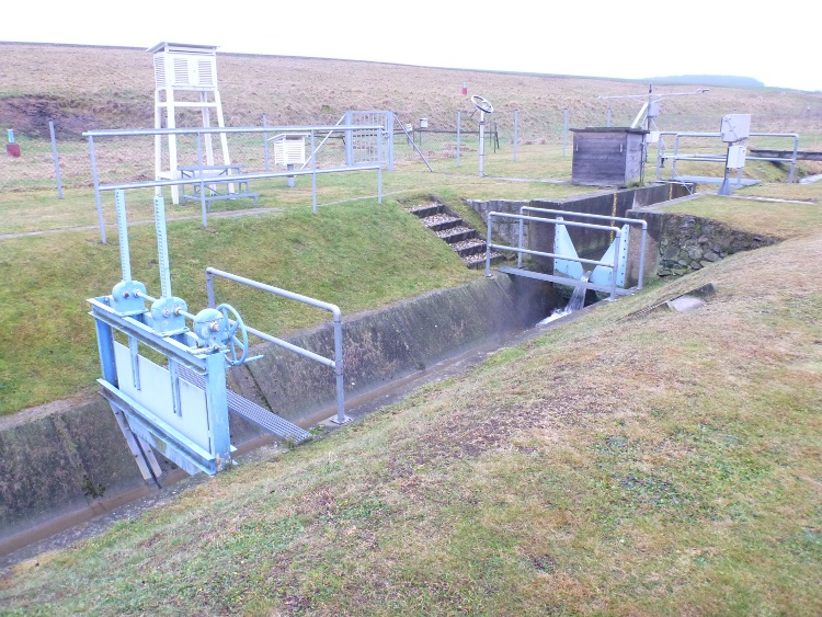
| 09:40, 5 April 2016 | Ultraschallpegel SEPTEMBER97 17A.png (file) |  |
174 KB | Thomas | Ultrasonic gauging station Duerreich | 1 |
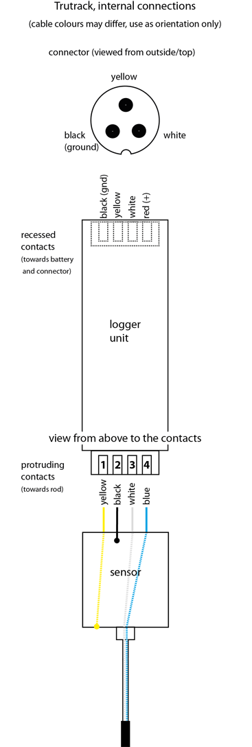
| 14:29, 15 April 2016 | Tt connections.png (file) |  |
76 KB | Till | Trutrack internal connections (pin configuration) | 2 |
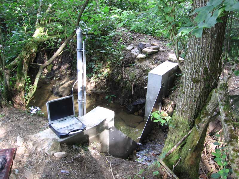
| 13:57, 29 September 2010 | Trutrack.jpg (file) |  |
216 KB | Till | Trutrack logger (2 m) at Capella, Spain | 1 |
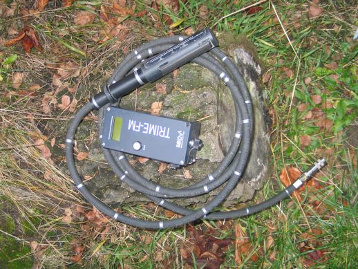
| 17:20, 6 October 2010 | Trime access tube probe.jpg (file) |  |
79 KB | Theresa | 2 | |
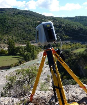
| 17:32, 31 May 2011 | Trimble gx.jpg (file) |  |
64 KB | Till | Trimble GX laser scanner in oblique setup to look downward | 2 |
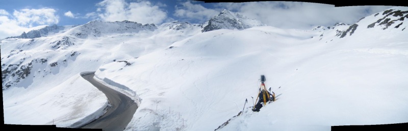
| 09:48, 26 April 2013 | TribleGX Panorama.jpg (file) |  |
59 KB | Till | Scanning snow cover using the Trimble GX in the Kaunertal, Austria. | 1 |
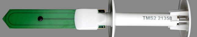
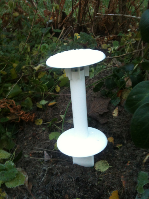
| 10:43, 25 November 2013 | Tms probe.png (file) |  |
280 KB | Thomas | 1 | |
| 09:32, 26 September 2013 | Tms1.jpg (file) | 31 KB | Thomas | TMS soil moisture sensor | 1 | |
| 14:06, 9 September 2011 | ThetaprobeMl2x.jpg (file) |  |
135 KB | Thomas | soilmoisture probe ML2X with HH2 | 1 |
| 14:52, 20 July 2021 | Test.jpg (file) |  |
90 KB | Till | 1 | |
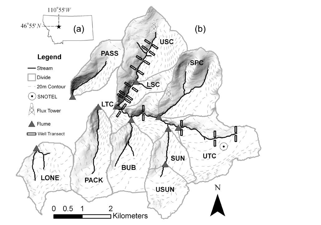
| 14:49, 9 April 2014 | Tenderfoot experimental Watershed.png (file) |  |
290 KB | Thomas | Tendefoot experimental watershed after Jencso et al. 2011 | 1 |
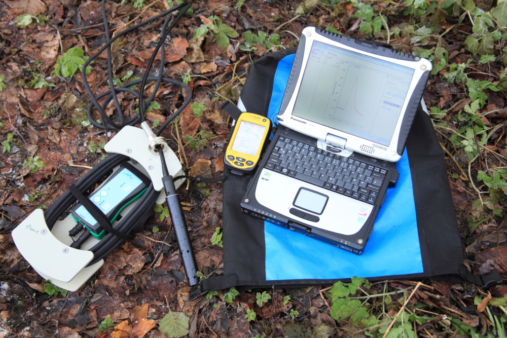
| 17:10, 27 November 2013 | TQ system fluorimeter.jpg (file) |  |
620 KB | Till | TQ-System with fluorescence sensor, PDA (Trimble Juno) and laptop (Panasonic Toughbook) | 1 |
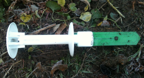
| 10:49, 25 November 2013 | TMS porbe installed.png (file) |  |
197 KB | Thomas | 1 | |
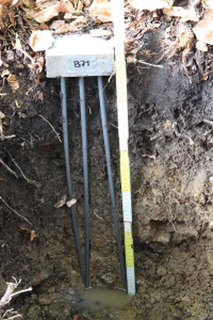
| 11:53, 21 July 2011 | TDR gley.JPG (file) |  |
140 KB | Thomas | 60 cm TDR probe in a gley soil in the Becherbach catchment Weisseritz | 2 |
| 01:12, 27 March 2007 | T5-tensiometer.jpg (file) |  |
15 KB | Ilja | T5 tensiometer | 1 |
| 21:49, 9 April 2007 | T4 field.jpg (file) |  |
104 KB | W75 | 1 | |
| 21:47, 9 April 2007 | T4 field.JPG (file) |  |
104 KB | W75 | 1 | |
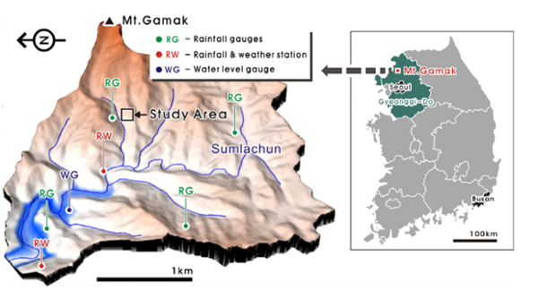
| 15:26, 10 September 2015 | Sulmachun catchment.png (file) |  |
195 KB | Thomas | Sulmachun catchment | 1 |
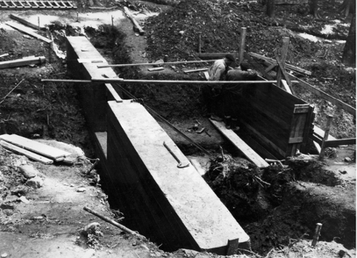
| 12:39, 21 July 2011 | Subsurface conrete dam schaefertal.jpg (file) |  |
139 KB | Thomas | Construction of the subsurface concrete dam of the Schaefertal catchment | 1 |
| 14:32, 6 March 2007 | Streamflow1.jpg (file) |  |
21 KB | Theresa | 1 | |
| 17:53, 6 March 2007 | Streamflow.jpg (file) |  |
21 KB | WikiSysop | 1 | |
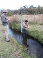
| 15:00, 20 July 2011 | Stemflow.JPG (file) |  |
141 KB | Thomas | stem flow measured with davis Weisseritz | 1 |
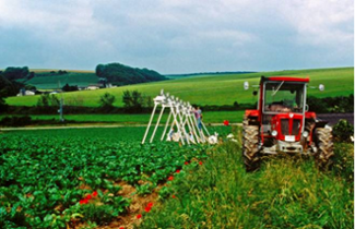
| 12:39, 24 September 2011 | Sprinklin Weiherbach.png (file) |  |
140 KB | Thomas | sprinkling experiment in the Weiherbach catchment | 1 |
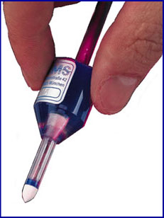
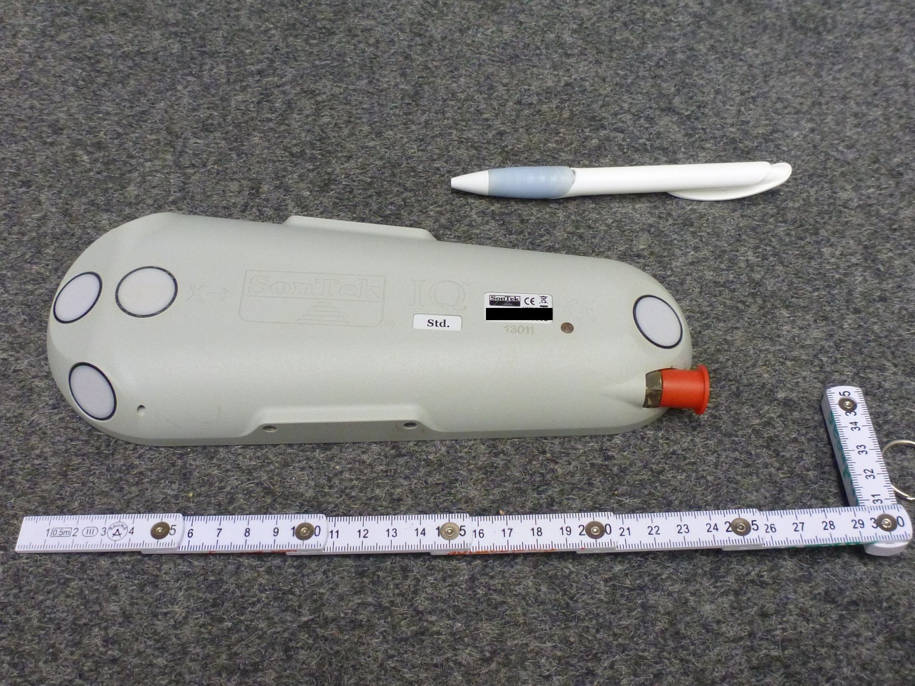
| 12:18, 17 July 2015 | Sontekiq.jpg (file) |  |
499 KB | Till | Sontek IQ Standard for continuous discharge measurement. The red cap covers the plug that is needed for power supply and data download. | 1 |
| 16:34, 20 July 2011 | Soil profile dye tracer.jpg (file) |  |
134 KB | Thomas | Soil profile with dye tracer Cambisoil Rehefeld hillslope Weisseritz | 2 |
| 08:33, 21 July 2021 | SoilVUE.jpg (file) |  |
260 KB | Till | SoilVUE10 soil moisture sensor (Campbell Sci) | 1 |
| 23:33, 8 July 2009 | SoilNet Router.jpg (file) |  |
113 KB | Theresa | 1 |