Uncategorized files
Jump to navigation
Jump to search
Showing below up to 50 results in range #51 to #100.
View (previous 50 | next 50) (20 | 50 | 100 | 250 | 500)
 GageAndLogger WithCoupler.jpg 903 × 644; 64 KB
 GageAndLogger WithoutCoupler.jpg 787 × 652; 58 KB
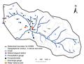
 Gauges of the Na Borges catchment.png 500 × 382; 218 KB
 HJ Andrews.jpg 503 × 379; 240 KB
 HM chamber.png 280 × 516; 292 KB
 HM meteorology.png 353 × 492; 217 KB
 HOAL.png 639 × 592; 292 KB
 HOBO snow.png 400 × 534; 281 KB
 HoboErrMsg1.jpg 444 × 168; 11 KB
 HoboErrMsg2.jpg 460 × 247; 17 KB
 HoellensteinHeadwaterCatchment.jpg 450 × 337; 44 KB
 Hood infiltometer.png 477 × 564; 741 KB
 Hood infiltrometer.png 434 × 383; 198 KB
 Huehnerwasser.png 200 × 175; 19 KB
 Huetelmoor Heiliger See evolution.png 850 × 296; 184 KB
 Huettelmoor view.JPG 500 × 333; 121 KB
 Hydra probe.jpg 110 × 110; 27 KB
 IMG 2598.jpg 389 × 518; 65 KB
 IMG 2603.jpg 600 × 800; 121 KB
 IMG 3959.jpg 640 × 480; 204 KB
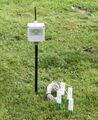 Image1.jpg 500 × 610; 51 KB
 Image2.gif 646 × 150; 14 KB
 KWBS - scheme2.jpg 1,690 × 1,279; 273 KB
 KWBS location3.jpg 1,444 × 1,007; 268 KB
 Klimastation Freifläche FEBRUAR97 19A.png 250 × 375; 173 KB
 Kolyma water-balance station 2016.JPG 2,816 × 2,112; 2.03 MB
 Kolyma water-balance station 2016 river valley.jpg 2,657 × 1,772; 5.62 MB
 Kolyma water-balance station 2016 rocky talus.JPG 2,657 × 1,772; 3.04 MB
 LaPueblaDeRoda.JPG 2,048 × 1,536; 279 KB
 Luxembourg int box framed.jpg 283 × 209; 40 KB
 MFT-2.JPG 500 × 375; 53 KB
 Maimai 2.png 3,587 × 1,916; 1.94 MB
 Maimai areal view.png 607 × 243; 391 KB
 Maimai stream and riparian zone.png 385 × 321; 251 KB
 Maimai throughfall trench.png 548 × 346; 401 KB
 Maimai vegetation patterns.png 640 × 480; 581 KB
 Mapkl.png 400 × 587; 276 KB
 Maxrisediagram.jpg 1,438 × 1,469; 142 KB
 Ml2x.jpg 400 × 300; 135 KB
 Ml3 deltaT.jpg 500 × 500; 15 KB
 Multiparameter ms5 ott.jpg 110 × 110; 26 KB
 NSG-Karte.jpg 738 × 724; 142 KB
 Na Borges catchment.png 550 × 443; 222 KB
 NachHQ150 LÄNGSPROFIL98 B1 19A.png 390 × 260; 202 KB
 Net-radiometer.jpg 800 × 600; 51 KB
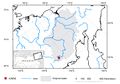
 Noordplas Polder.png 900 × 959; 286 KB
 Odyssey.jpg 150 × 200; 25 KB
 Ombrometer.jpg 600 × 450; 27 KB
 Overland flow Weiherbach.png 335 × 216; 145 KB
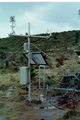
 P1030849.JPG 1,920 × 2,560; 3.4 MB


