Difference between revisions of "Hütelmoor catchment"
Jump to navigation
Jump to search
| Line 33: | Line 33: | ||
* Water level (diver) and runoff | * Water level (diver) and runoff | ||
* electrical conductivity (diver) | * electrical conductivity (diver) | ||
| − | * soil moisture ([[The "Things that went wrong"-Story of the Month | TDR]], [[Soil moisture - impedance method (Theta Probe)|impedance FDR| Theta porobes ]], [[Soil moisture - capacitance (5TE Decagon)| capacitance FDR| 5TE Decagon]], [[TMS - sensor|Soil moisture - capacitance (TMS)]], profile probe ) | + | * soil moisture ([[The "Things that went wrong"-Story of the Month | TDR]], [[Soil moisture - impedance method (Theta Probe)|impedance FDR| Theta porobes ]], [[Soil moisture - capacitance (5TE Decagon)| capacitance FDR| 5TE Decagon]], [[TMS - sensor|Soil moisture - capacitance (TMS)]], [[profile probe| Soil moisture - FDR (profile probe)]] ) |
* CH4 emission, chamber measurment | * CH4 emission, chamber measurment | ||
* Eddi covariance | * Eddi covariance | ||
Revision as of 08:58, 3 April 2014
Location
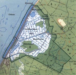
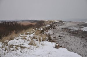
In the Rostocker Heide, Mecklenburg-West Pomerania, Germany
Catchment size
10 km²
Climate
Maritime, anual precipitation 610 mm, anual ETp 640 mm, mean yearly temperature 8.3°C
Geology
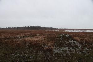
Glacifuvial, with intensive peat evolution
Topography
0-40 m above sea level
Vegetation/Land use
Forest 60 %, pasture 30%, peat 10%
Context of investigation
CH4 emission, salinisation, hydrological processes
Measurements/Equipment
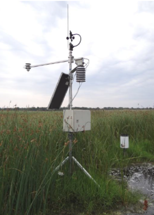
- Meteorological station
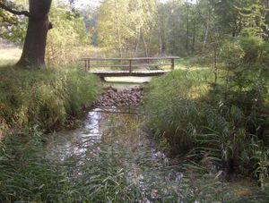
- Runoff
- Water level (diver) and runoff
- electrical conductivity (diver)
- soil moisture ( TDR, impedance FDR| Theta porobes , capacitance FDR| 5TE Decagon, Soil moisture - capacitance (TMS), Soil moisture - FDR (profile probe) )
- CH4 emission, chamber measurment
- Eddi covariance
- water level
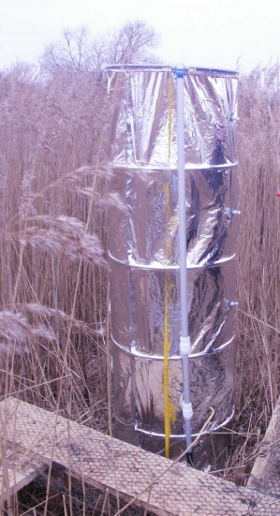
- Water level + electric conductivity
Links to project webpages
other Links
- Rostocker Heide at Wikipedia
- Chair for Hydrology and Chair for Landscape Ecology and Site Evaluation University Rostock
References
- Bohne, K., Bohne, B., Prediction of salinization by flooding sandy soils with brackish water, in Fock, T., Hergarden, K., Repasi, D., Salt grasslands and coastal meadows in the Baltic Sea region, PROCEEDINGS OF THE 1ST CONFERENCE, Neubrandenburg, Reihe A: Band 18, 2002.
- Bohne, B., Bohne, K., Monitoring zum Wasserhaushalt einer auf litoralem Versumpfungsmoor gewachsenen Regenmoorkalotte - Beispiel Naturschutzgebiet "Hütelmoor" bei Rostock. In: Stüdemann, O., Aspekte der Geoökologie Weißensee Verlag, Berlin, 2008.
- Koebsch, F., Glatzel, S., Jurasinski, G., Vegetation controls methane emissions in a coastal brackish fen, WETLANDS ECOLOGY AND MANAGEMENT 21(5), 323-337, DOI: 10.1007/s11273-013-9304-8, 2013.
- Koebsch, F., Glatzel, S., Hofmann, J., Forbrich, I., Jurasinski, G., CO2 exchange of a temperate fen during the conversion from moderately rewetting to flooding, JOURNAL OF GEOPHYSICAL RESEARCH-BIOGEOSCIENCES 118(2), 940-950, DOI: 10.1002/jgrg.20069, 2013.
- Kolp, O., Die nordöstliche Heide Mecklenburgs. Rostocker Heide, Gelbensander Forst, Forst Alte Heide, Ribnitzer Forst. Geographische Gesellschaft in der Deutschen Demokratischen Republik. Abhandlungen Nr.1 . Berlin, Deutscher Verlag der Wissenschaften, 1957.
- Niedermeyer, R.- O., Lampe, R., Janke, W., Schwarzer, K., Duphorn, K., Kliewe, H., Werner, F., Die deutsche Ostseeküste, 2. Auflage, Gebr. Borntraeger (Stuttgart), Sammlung Geologischer Führer, Band 105, 2011.
